MYANMAR STATES AND REGIONS
- Territory Guide
- MYANMAR STATES AND REGIONS
Add Myanmar States and Regions to your map for intensified location understanding. How well do you know your customers and target markets in each state and region? Here in Mapline, your location understanding will be intensified once you add these administrative divisions to your map. Start visualizing the future of your business by state and region mapping. Since the territories are focused on a larger scale, you can easily see details that matter to your business.
Here in Mapline, we’ll let you experience the no-nonsense mapping of states and regional boundaries in less than a minute!
WHAT ARE MYANMAR STATES AND REGIONS?
Before 1989, Myanmar was known as “Burma.” It is located in Southeast Asia. Myanmar is divided into seven states and seven regions. Regions are the homes of the dominant ethnic group while the states are inhabited by ethnic minorities. The states and regions are further divided into districts, and sub-divided again into wards, townships, and villages.
How well do you know your customers and target markets in each state and region? When you create a map of Myanmar states and regions, a clear picture beyond ethnic cultures is presented as you incorporate location data to drive new insights. Whether you’re planning marketing campaigns for the whole country, managing a supply chain, or tracking sales across regions, leveraging states and regions to your map pushes you to improve critical decision-making.
ADD MYANMAR STATES AND REGIONS
Analyze your perspectives within the state and region-level boundaries to have a more data-driven insights that impact your business. These opportunities can ultimately strengthen your competitive edge and enhance your brand presence all throughout the country.
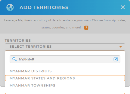
Add a new territory from Mapline’s repository to gain sharper lenses and see how your business operations progress. In the search bar, type MYANMAR and choose MYANMAR STATES AND REGIONS from the selections.
That’s it, and you’re done with the first step.


Pro Tip: Get easy access to different territory boundaries for Myanmar from Mapline’s Repository. That includes Myanmar districts, Myanmar townships, and states and regions, that can be easily added to your map.
CHOOSE STATE AND REGION COLORS
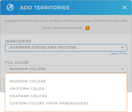
Now, let color-coded territories take your analysis to a whole new level! In fact, territory insights seamlessly arise to use for sales strategies, identify trends, manage risks, and more! Choose static colors if you want to highlight specific regions. Choose dynamic colors to showcase your sales data.
Select your preferred color styles that match your level of analysis.
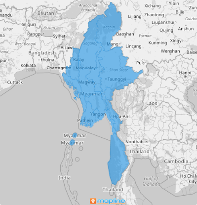
When you have configured your color style settings, click OK and your map of Myanmar states and regions is good to go.

GET NEW TERRITORY INSIGHTS
Make these capabilities work for you and discover new location insights in seconds!
- Edit and style your routes to reach the utmost service efficiency
- Click into territory reports to know more about an individual state or region in terms of demographics, sales, etc.
- Incorporate your spreadsheet location data to establish more efficient workflows


