THE NETHERLANDS MUNICIPALITIES
- Territory Guide
- THE NETHERLANDS MUNICIPALITIES
When it comes to business planning, mapping The Netherlands municipalities is like having a superpower. It lets you see the lay of the land—literally—so you can make decisions with the strength and precision of a well-thrown punch. By analyzing hyper-local factors at the municipality level, you get a close-up view of the market, allowing you to craft strategies that hit the target every time. This level of insight is what gives you the edge, helping you plan with the same focus and effectiveness that it takes to save the day.
Turn this powerful tool into your secret weapon for business success. Let’s waste no time, let’s start now!
WHAT ARE THE NETHERLANDS MUNICIPALITIES?
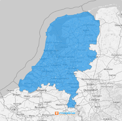
The Netherlands may be divided into 355 municipalities, but when you map them out, you’re not just looking at lines on a map—you’re uncovering where the real action is. Whether you’re trying to spot areas with frequent service requests or zero in on your ideal target audience, this approach lets you deploy your teams and strategies with precision. It’s like knowing exactly where to put your strength to get the job done right.
Here’s how you’ll get started.
ADD THE NETHERLANDS MUNICIPALITIES
Adding municipal boundaries in Mapline is so easy that it will only take you two steps to follow. When you’re done, you can start your municipality-level data analysis to strengthen your business for localized market analysis, targeted marketing campaigns, and resource allocation.
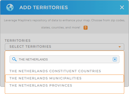
Click on the ADD button on the left side of your map to add a new territory from Mapline’s repository. Use the search bar and type THE NETHERLANDS instead of scrolling down to cut down on searching. Then select THE NETHERLANDS MUNICIPALITIES.


Pro Tip: Mapline’s Territory Repository lets you create customized maps with specific geographic boundaries that suit your business needs. Creating custom maps with The Netherlands provinces, The Netherlands municipalities, and The Netherlands constituent countries, can provide a clearer picture of your operational landscape and support better decision-making.
CHOOSE MUNICIPALITY COLORS
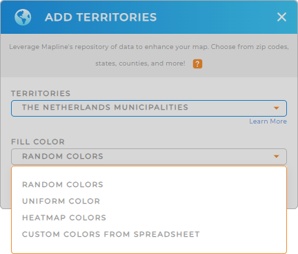
Now, decide on the appearance of your map based on its purpose or the type of data you want to highlight. A color-coded map based on data helps in emphasizing differences and uncovering insights. You can also either apply a uniform color or random colors. They both work well for simplicity and clarity. Choose the right color styling to ensure that your map effectively communicates the information and supports your business objectives.
When you have configured the right type of colors for your territory, hit OK and you’re done!

GET NEW TERRITORY INSIGHTS
Now, learn new insights to sharpen your decision-making as you add these capabilities to your municipality territory map:
- Quickly attach files to your data on an as-needed basis with file column
- Empower team accountability when you add new form
- Share information with your team in seconds


