NIGER DEPARTMENTS
- Territory Guide
- NIGER DEPARTMENTS
Add Niger departments to your map to supercharge your brand’s analytics and streamline operations. Visualizing these administrative divisions gives you a clear, comprehensive understanding of regional performance, customer behavior, and market trends. This level of detail allows you to fine-tune strategies for specific areas, ensuring your marketing campaigns, sales efforts, and logistics are perfectly aligned with local demands. Imagine having the power to make data-driven decisions backed by precise regional insights. With this granular level of analysis, you can easily pinpoint high-potential departments, allocate resources, and optimize distribution routes more effectively.
Ready to take your strategic planning to the next level? Discover how leveraging Niger’s departments can transform your business approach.
WHAT ARE NIGER DEPARTMENTS?
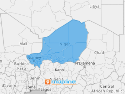
Niger, a landlocked nation at the heart of Africa, is organized into regions that are further divided into 63 departments—its essential second-level administrative units. Each department provides a targeted lens for insightful data analysis, supporting regional governance and planning efforts. By mapping Niger’s departments, businesses can sharpen their approach to managing sales territories, optimizing marketing campaigns, and streamlining logistics. This strategic view transforms complex ideas into actionable insights, helping you align more closely with local market dynamics.
For instance, if you’re running a logistics firm, you can utilize the map to optimize delivery routes, ensuring timely and efficient service, while your marketing team can concentrate promotions on regions with the highest potential. This targeted approach to mapping not only boosts efficiency but also drives deeper market penetration, setting the stage for greater business success.
ADD NIGER DEPARTMENTS
Adding Niger’s departments to your map is both simple and impactful. By visualizing the geographic distribution of your logistics activities, you can identify inefficiencies, optimize routes, and allocate resources more effectively.
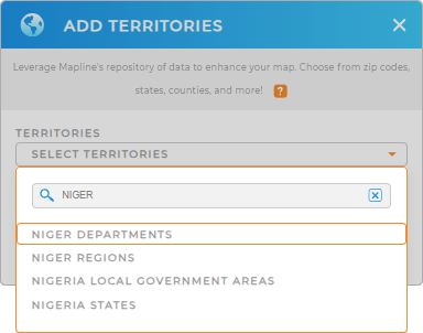
To add a new territory from Mapline’s repository, type NIGER into the search bar and select NIGER DEPARTMENTS.
With these steps, you can quickly enhance your map, gaining a clearer view of regional dynamics and optimizing your business strategies effectively!


Pro Tip: Mapline’s worldwide territory repository offers a comprehensive list of territory boundaries. Add different boundaries to your map including Niger regions and departments to go over different regional trends with a fine-tooth comb and elevate your strategic analysis capabilities.
CHOOSE DEPARTMENT COLORS
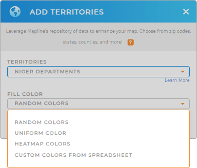
Apply color styles to Niger’s departments on your map to significantly enhance your business analytics and operational efficiency. Color-coded departments allow you to swiftly pinpoint key data points, such as high-performing regions and areas that require immediate attention. This visual clarity not only streamlines your analysis but also empowers you to make informed decisions that drive growth and optimize resource allocation across the country.
Customize your map by applying the best color styling option that perfectly suits your type of analysis. Lastly, click OK. That sums up the process of adding Niger departments to your map.

GET NEW TERRITORY INSIGHTS
Now, try leveraging Mapline’s powerful capabilities that enable you to dive deeper into your data, revealing trends and patterns that can inform your business strategies:
- Add custom labels to your map for quick recognition and analysis
- Generate detailed reports on individual departments
- Harness the power of pin styling to identify top-performing sales points


