NIGERIA STATES
- Territory Guide
- NIGERIA STATES
A map of Nigeria states can supercharge your logistics operations by offering clear, actionable insights. By visualizing these regions, you can pinpoint high-demand areas, optimize delivery routes, and manage your resources more effectively. When you know precisely which states require more attention and which ones are running smoothly, you gain the power to anticipate challenges, adapt strategies on the fly, and ensure timely operations across the board.
Let’s explore how to add Nigeria’s states to your map, allowing you to streamline your logistics and enhance your overall efficiency!
WHAT ARE NIGERIA STATES?
Often referred to as the “Giant of Africa” due to its booming economy and rapidly growing population, Nigeria boasts the 20th largest economy in the world. The country is comprised of 36 states plus the Federal Capital Territory. States are the primary regional divisions within Nigeria, much like states in the USA. Mapping these states enables you to pinpoint areas with frequent service requests, optimize technician dispatch routes, and deploy your resources more efficiently.
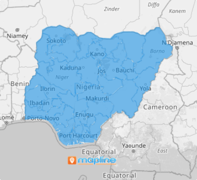
Business leaders are leveraging a map of Nigeria states to enhance their business processes through location intelligence. A state map of Nigeria helps you gain valuable visual insights into key geographic locations. This approach will allow your sales and marketing teams to work in perfect harmony, optimizing your strategies and ensuring alignment with regional demands. With this powerful territory mapping, you can make informed decisions that drive growth and success in the Nigerian market!
ADD NIGERIA STATES
Add state boundaries to your map now to help you make data-driven decisions that can streamline operations and minimize expenses. Just by doing this easy step, you’re on the road to enhancing your operational efficiency and driving cost savings, ultimately boosting your bottom line.
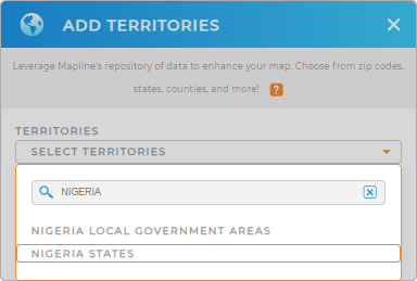
Gain a high-level overview of your logistics across the country when you add a new territory from Mapline’s repository. Type NIGERIA into the search bar to click NIGERIA STATES and add to your map.


Pro Tip: Mapline’s extensive list of territory boundaries enables you to add precise regional divisions to your map effortlessly. Explore additional regions, including Nigeria local government areas and states to compare data across borders and uncover new insights.
CHOOSE STATE COLORS
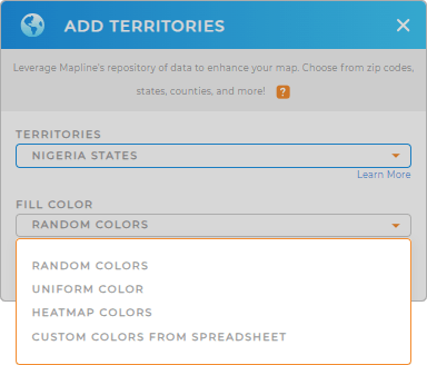
Step 2 is about applying territory colors. Complete this final quick step, and you’ll be ready to unlock valuable insights that will enhance your operations and streamline your decision-making process. Color-coding your Nigeria states map enhances your understanding of regional dynamics empowering you to make informed decisions that drive growth and optimize your strategies effectively.
Since territory colors are crucial to help you focus on performance metrics at a glance, Mapline provides the best color styling options suitable for all types of analysis. Select your desired color styles, then click OK.

GET NEW TERRITORY INSIGHTS
With these advanced visualization and analytical capabilities, you can explore demographic information, identify high-potential regions, and optimize your operations like never before:
- Create precise sales territories in just a few clicks
- Calculate center points to pinpoint the optimal location for a new store
- Apply segments to compare and contrast each pin grouping


