BELIZE DISTRICTS
- Territory Guide
- BELIZE DISTRICTS
Add Belize districts to your map and unlock pinpoint accuracy. Identifying high-demand areas, visualize new customer markets, and develop highly-targeted strategies for increasing your bottom line!
By visualizing these districts, you’ll be able to see exactly where your services are most needed and tailor your efforts to those regions. This kind of detailed territory mapping can be a game-changer for your brand. It allows you to identify potential target areas because you have a deeper knowledge on the ins and outs of each district. Ready to boost your business with actionable insights? Let’s get started!
WHAT ARE BELIZE DISTRICTS?
Belize, located on the eastern coast of Central America, is divided into six districts. With an average annual population growth of 1.87%, the country has the lowest population density in Central America.
Leveraging a map of Belize districts helps you understand regional demand and optimize your distribution accordingly. By mapping these districts, you can prioritize high-traffic areas and streamline your operations. This targeted approach enables you to manage your resources more effectively and improve service delivery. Utilizing Belize districts for your logistics strategy can bring clarity and efficiency to your daily tasks.
ADD BELIZE DISTRICTS
Tap into the power of adding Belize districts to gain enhanced visibility into regional performance and better resource management.
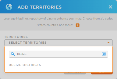
First, add a new territory from Mapline’s repository. Type BELIZE into the search bar, and select BELIZE DISTRICTS.
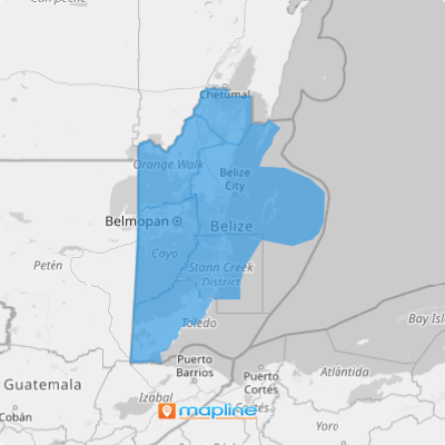
With district boundaries plotted on your map, you can seamlessly craft location-focused business plans, analyze district trends, optimize routes, and so much more!


Pro Tip: Mapline’s extensive repository of territory boundaries enables you to add regions from various countries to your map, expanding your logistics capabilities globally. Explore different territories to discover the best combinations for your business and stay competitive.
CHOOSE DISTRICT COLORS
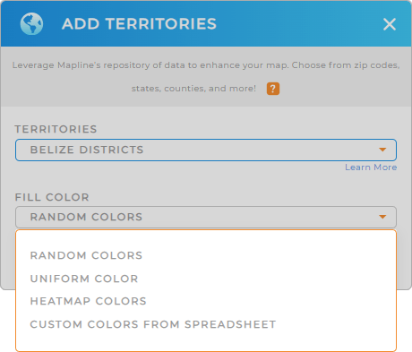
Color-coding your Belize districts is essential for clear and effective data visualization. By assigning different colors to each district, you can easily identify regional trends, monitor performance, and optimize your operations.
First, select your desired color styling and click OK.
Woah! You just created a powerful visual tool for deeper analytics! Let’s check out what else you can do with your map.

GET NEW TERRITORY INSIGHTS
Unlock more valuable insights that were previously hidden in your data by using these powerful capabilities:
- Filter your data to identify regions with the highest delivery delays and implement targeted solutions to improve efficiency
- Track product demand variations across different districts to optimize inventory distribution
- Analyze feedback from various regions to tailor services and enhance customer satisfaction


