DOMINICAN REPUBLIC MUNICIPALITIES
- Territory Guide
- DOMINICAN REPUBLIC MUNICIPALITIES
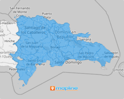
Elevate your analysis by incorporating the Dominican Republic municipalities into your map. This isn’t just about broadening your geographic perspective—it’s about unlocking a deeper understanding of how these boundaries impact your business growth. Imagine mapping out municipalities and instantly seeing how local factors shape your strategy! With these insights, you can tailor your approach to address the specific needs of each area, optimize your operations, and drive growth with precision.
Gain a clear, actionable perspective that helps you spot opportunities, adapt to regional trends, and make smarter decisions with confidence.
WHAT ARE DOMINICAN REPUBLIC MUNICIPALITIES?
The Dominican Republic, a vibrant gem in the Caribbean, is located on the island of Hispaniola, nestled in the stunning Greater Antilles. Dominican Republic is the economic powerhouse of the Caribbean, boasting the largest economy in the region and the seventh-largest in Latin America. The 124 municipalities are the backbone of the nation’s administrative structure, playing a crucial role in governance and regional development. Mapping the municipalities of the Dominican Republic serves as a cornerstone for effective data analysis. This approach is invaluable for business owners, particularly in a country boasting the fastest-growing economy in Latin America.
For business owners, mapping these municipalities isn’t just a geographical task—it’s a key to unlocking smarter, more strategic analysis in a nation with Latin America’s fastest-growing economy. Understanding the layout and divisions of the Dominican Republic municipalities can offer invaluable insights and opportunities for growth in this dynamic marketplace.
ADD DOMINICAN REPUBLIC MUNICIPALITIES
Connect your insights with a map of the Dominican Republic’s municipalities to reveal the spatial factors shaping your business. Imagine having first-hand access to critical insights that impact your operations! With this information at your fingertips, you can swiftly pivot your plans and strategies, leading to more customized marketing efforts that drive your business forward.
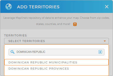
Follow these simple steps and you will develop a powerful map in just a few seconds! To outline these geographic boundaries, first, add a new territory from Mapline’s repository. Type DOMINICAN REPUBLIC into the search bar and select DOMINICAN REPUBLIC MUNICIPALITIES to add it to your map.
In just a few clicks, you’ll be done!


Pro Tip: Tap into the many potentials of Mapline’s global territory repository to advance your spatial analysis capabilities. Add Dominican Republic provinces and municipalities to your map to find out more valuable insights.
CHOOSE MUNICIPALITY COLORS
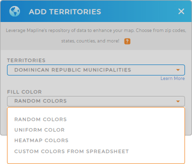
Color-coding your municipality map is a powerful strategy for highlighting critical points. Colors deliver visual enhancements that allow you to quickly identify high and low-performing regions and other key performance indicators impacting your bottom line. This streamlined analysis saves you time, enabling you to concentrate on essential tasks like developing new business plans or crafting innovative marketing strategies.
Mapline’s color styles empower you to understand complex information at a glance. Choose one that will best match your type of analysis. Then click OK when you’ve configured your settings.
That’s how fast adding the Dominican Republic municipalities to your map!

GET NEW TERRITORY INSIGHTS
Maximize the potential of your Dominican Republic municipality map by leveraging these capabilities to unlock valuable insights:
- Generate graphs and charts in a snap
- Discover market opportunities unique to Dominican Republic when you segment your data
- Easily pull data from Salesforce or Google Sheets


