
Mapping Municipalities of Dominican Republic Answers the Question “Where?”
Mapping Solves Data Problems
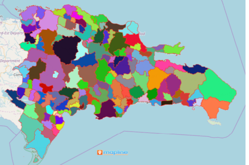
Mapping municipalities of Dominican Republic is a focal point for data analysis. It is used by municipal councils and business owners alike. Dominican Republic has the fastest growing economy in Latin America. Some of the industries that contribute to its economic growth are construction, mining, manufacturing, and tourism. Dominican Republic is made up of 124 municipalities. Consequently, when research and analysis are done in a municipality-level, the best locations can be identified. Hence, a map with an overlay of municipality boundary is a valued tool for market research. It is also used in customer analysis, and site analysis.
A map showing all the municipalities of Dominican Republic is used for territory planning. It is where decisions makers based their insights. As a result, by integrating locations, the users are able to come up with an informed decision.
Mapping Helps Form a Pattern
Follow these simple steps and you will come up with a powerful map in just a few seconds! The map will show how locations really matter. For that reason, the map shows the connections and patterns that lie underneath your data.
- Create a Mapline account and login.
- Click the orange “Add New Items” button.
- Select “New Map” on the drop down arrow.
- Give your map a name and click “OK.”
- Click the “Add” button from the left sidebar.
- Select the “Territories” option.
- Click “From Mapline’s Repository.”
- From the “Territories” select “Dominican Republic Municipalities.” You can also enter that on the search bar.
- Select how you want your boundaries to be colored in “Fill Color” (Random Colors, Uniform Color, Dynamic heat map colors, or Custom colors from spreadsheet).
- Click “OK.”
Sign up now to choose the best location for your business. Learn how other mapping tools can be used to help establish your business with long-term economic sustainability.