
Experience the Benefits of Mapping American Indian Tribal Subdivisions in the USA with Mapline
Tribal Subdivision Boundaries for a More Focused Territory Management
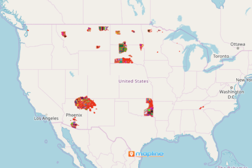
The long wait is over. Finally, mapping American Indian Tribal Subdivisions in the USA is now made possible by Mapline! A tribal subdivision is an area that is federally recognized by American Indian reservations or a statistical subdivision of OTSAs (Oklahoma Tribal Statistical Areas). The tribal subdivisions comprises an internal unit of self-government that manages the cultural, economic, and social purposes for the American Indians on the reservations, OTSAs, and off-reservation trust lands. A map with an overlay of American Indian tribal subdivision boundaries makes your interactive data analysis so much simpler.
You can do so much more with your territory map. Use more mapping tools like heat maps and distance analysis to manage individual territories. The tools are designed to be intuitive and easy to use so you can spend more time discovering insights that really matter.
Start Mapping Tribal Subdivisions of American Indians Now!
Creating a special territory map like the American Indian Tribal Subdivisions can be done in a few clicks. Just follow these steps:
- Create a Mapline account and login.
- Click the orange “Add New Items” button.
- Select “New Map” on the drop down arrow.
- Give your map a name and click “OK.”
- Click the “Add” button from the left sidebar.
- Select the “Territories” option.
- Click “From Mapline’s Repository.”
- From the “Territories” select “U.S. – American Indian Tribal Subdivision (2019).” You can also enter that on the search bar.
- Select how you want your boundaries to be colored in “Fill Color” (Random Colors, Uniform Color, Dynamic heat map colors, or Custom colors from spreadsheet).
- Click “OK.”
Sign up now to access a hundred more special territories. Learn how to drastically improve your territory management.