
Mapping US Electric Utility Service Areas
A Great Way to Map The US Electric Utility Service Areas
Mapping the US Electric Utility Service Areas is a challenge for some organizations. For example, there may be one city that may be serviced by only one company. On the other hand, there may be different companies that service one city. Indeed, the Electric Utility Service Areas is a special boundary. It is unique in a way that it does not follow the municipal boundaries. Rather, it has its own boundary. How? Here’s how it works.
The government grants the electric companies to be the distributor in particular areas. They service residential and commercial properties. Those are their boundaries. As a result, an electric utility company may service more than one city. Examples of Electric Utility companies are The Pacific Gas and Electric and Southern California Edison.
Because Electric Utility Service Areas boundary is important in geographic analysis, Mapline makes it possible to create a map of Electric Utility Service Areas in the US!
On-the-speed Mapping US Electric Utility Service Areas
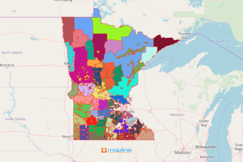
Now, you can map the US Electric Utility Service Areas in these states: California, Kentucky, Maine, Minnesota, Mississippi, North Carolina, South Carolina, and Ohio. Just follow these steps:
- Create a Mapline account and login.
- Click the orange “Add New Items” button.
- Select “New Map” on the drop down arrow.
- Give your map a name and click “OK.”
- Click the “Add” button from the left sidebar.
- Select the “Territories” option.
- Click “From Mapline’s Repository.”
- From the “Territories” select “U.S. Electric Utility Service Areas” and add a state of your choice. You can also enter that on the search bar.
- Select how you want your boundaries to be colored in “Fill Color” (Random Colors, Uniform Color, Dynamic heat map colors, or Custom colors from spreadsheet).
- Click “OK.”
Finally, with your map, you can immediately perform an in-depth analysis. Lastly, you can plan seamlessly for your organization’s productivity. Sign up now to begin mapping the Electric Utility Service Areas in the USA!