NORTH KOREA COUNTIES
- Territory Guide
- NORTH KOREA COUNTIES
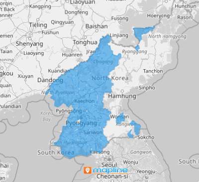
A map of North Korea’s counties gives you the ability to pinpoint areas that are thriving and those that require more attention. This territory map is a powerful analytical tool, allowing you to analyze patterns and trends more quickly and efficiently than ever before. By minimizing the time spent on analytics, you can focus more on crafting and implementing strategies that enhance your business operations and drive success. With this streamlined approach, you’ll be able to make informed decisions faster and devote more energy to executing plans that make a real impact.
How convenient is that?
WHAT ARE NORTH KOREA COUNTIES?
The Democratic People’s Republic of Korea, located in East Asia, established three hierarchical division levels in 2002. At the second administrative level, counties represent the less urbanized areas within a province or directly governed cities. Conducting a county-level analysis can significantly enhance your data visualization, making it easier to identify underserved areas and optimize resource allocation seamlessly.
By incorporating these boundaries into your map, you can start seeing remarkable improvements in your business operations. Don’t wait—add these boundaries to your map now and unlock the full potential of a geo-powered analytics!
ADD NORTH KOREA COUNTIES
Adding North Korea counties to your map is like adding unparalleled precision to your analytics! It empowers you to understand your market coverage, identify the gaps between your sales territories, and more.
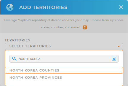
It’s so easy to add a new territory from Mapline’s repository. Just fill out the search bar with NORTH KOREA to trim down the selections. Then, click to add NORTH KOREA COUNTIES.
It couldn’t be any easier than that!


Pro Tip: Explore the versatility of Mapline’s territory repository by adding North Korea provinces and counties to your map. Unlock fresh insights tailored to your specific business needs when you incorporate different types of territories.
CHOOSE COUNTY COLORS
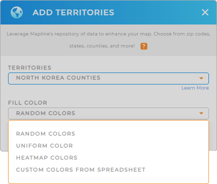
Next is to fill your territory with colors. Leveraging color styles ignites insights that sharpen your decision making, leaving you with almost no room for mistakes. For instance, a color-coded map can highlight concentrations that can help with targeted marketing strategies.
To accomplish that, Mapline provides the best color styles to choose from – random, uniform, heat map, and custom colors. Any of these selections will greatly improve your visualization, guiding you to make strategic decisions.
Once you have configured your color choice, click OK and you can start analyzing your map of North Korea counties.

GET NEW TERRITORY INSIGHTS
Discover deeper insights as you add these powerful capabilities:
- Create optimized, one-time routes
- Calculate the ROI of each of your stores using formulas
- Compare competitor locations with Mapline Data


