NORWAY MUNICIPALITIES
- Territory Guide
- NORWAY MUNICIPALITIES
Boost your business’s operational efficiency to superhero levels with a map of Norway municipalities! At your fingertips, you have the power to add municipality boundaries to your map in a flash! In just a few minutes, you’ll see your customer locations spring to life, aligning perfectly with these boundaries across the map. This isn’t just about looking at dots on a map; it’s about transforming how you segment customers, optimizing your logistics, shaping distribution routes, and deploying your sales teams with unmatched precision.
Trying to add municipality boundaries? In Mapline, you can do so faster than a speeding bullet! You’ll be done before you even know it!
WHAT ARE NORWAY MUNICIPALITIES?
Located in the heart of Europe, Norway is carved into 357 municipalities, each a fundamental pillar of local governance. These municipalities are more than just map markers; they’re vibrant hubs of economic activity, health services, education, and social services. Every municipality offers a unique blend of opportunities and challenges.
When you harness regional insights to intensify your understanding of customer dynamics, you gain a competitive edge like no other. With this knowledge, you can launch campaigns that not only reach but resonate deeply with your target audiences, tailored precisely to the fabric of each municipality. Ready to unlock this potential? Let’s map out our path to success!
ADD NORWAY MUNICIPALITIES
Identify underserved areas for business growth as you visualize the unique geographic and market dynamics at play in Norway. Add municipality boundaries to your map now to unlock key insights.
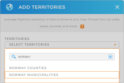
First, add a new territory from Mapline’s repository. Type NORWAY into the search bar, and select NORWAY MUNICIPALITIES.
We told you that was fast.


Pro Tip: Take advantage of Mapline’s Repository to unlock powerful new insights. The global repository allows you to add precise regional boundaries to your map, including Norway counties and municipalities. What a powerful way to analyze and optimize your operations within Norway!
CHOOSE MUNICIPALITY COLORS
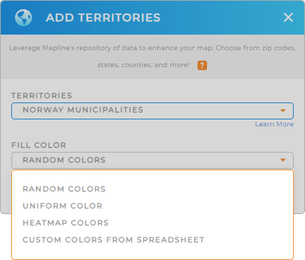
Now that you have added the right boundaries to your map, the next best thing to do is to apply color styles. Whatever type of analysis you’re doing, you can customize your map with intelligent color style options – random colors to differentiate each municipality, uniform color for clean presentation, heat map colors to identify data density, or custom colors based on specific criteria.
Choose the best color styles fitting to the type of analysis you’re doing, then click OK.
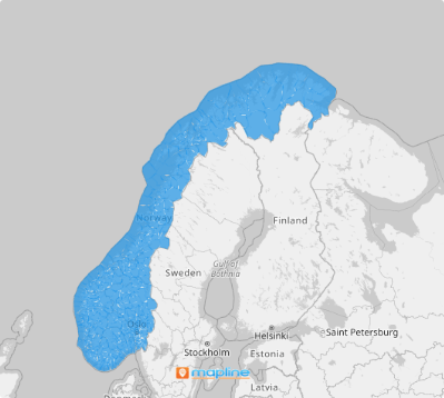
That’s it! You can now start making location and data analysis with your territory map.

GET NEW TERRITORY INSIGHTS
Stay ahead of the competition as you apply these capabilities in your analysis with a map of Norway municipalities:
- Configure new charts and reports
- Adjust territory borders for territory sales management
- Manage, enhance, and analyze your data, making it a game-changer for your business


