PERU DISTRICTS
- Territory Guide
- PERU DISTRICTS
Leverage a map of Peru districts to develop customized strategies through district-level analysis. Because districts offer a granular view, brands can create more localized and effective marketing campaigns. By visualizing district boundaries on a map, you can craft marketing strategies that align with the unique social and economic characteristics of each district, ensuring your approach resonates with the local audience and drives better results. With these insights, you’re not just meeting expectations—you’re creating extremely successful strategies to target specific markets that keep your business ahead of the competition.
Let’s get started with creating a Peru district map in just a minute or less!
WHAT ARE PERU DISTRICTS?
Peru is a megadiverse country situated in South America. It is divided into 1,869 districts. A map of Peru districts is a clear visual representation tool for optimizing your sales strategy. Mapping out the regions is an exceptional way to easily identify areas with the highest potential so you can craft better business plans for sales route optimization.
Kickstart your sales and marketing game with a powerful district territory map—plan smarter, sell faster! Compare and contrast your sales performance by region and quickly adjust your plans accordingly. This helps in targeting marketing efforts and resources more efficiently.
ADD PERU DISTRICTS
Visualizing the performance of each district can provide valuable insights into where to focus your efforts. Imagine knowing exactly which districts need more attention and which ones are thriving. This leads to better customer engagement when you address customers’ specific needs in each district, like offering certain promotions and discounts.
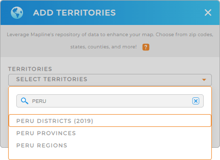
The first step is to add a new territory from Mapline’s repository, type PERU into the search bar, and select PERU DISTRICTS.
Now, let’s take you to Step 2.


Pro Tip: Mapline’s extensive list of territory boundaries can be a powerful asset for global logistics management. By adding regions like Peru districts, Peru provinces, and Peru regions to your map, you can streamline your logistics operations, improve route planning, and enhance overall efficiency.
CHOOSE DISTRICT COLORS
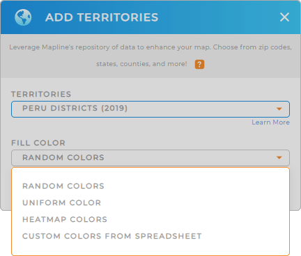
Now, improve the quality of your analysis by applying colors to enhance your territory boundaries. With a color-coded district map, you can easily identify trends and outliers. Imagine getting that clear picture in seconds! Then, you can turn your focus more on the outliers, understand their challenges, and devise strategies to improve your performance. How awesome is that?
To color-code your district map, add color styles to your territories.
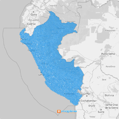
And you’re done! You’ve successfully added Peru districts to your map in under a minute. Enjoy your enhanced visualization and insights!

GET NEW TERRITORY INSIGHTS
Enhance your district-level analysis by adding these capabilities to your map of Peru districts:
- View territory reports to save a ton of time and make your workflow smoother
- Set up a comprehensive CRM that tracks everything
- Transform information into a clear and concise picture to easily analyze trends, comparisons, or relationships between data points


