SAINT VINCENT AND GRENADINES PARISHES
- Territory Guide
- SAINT VINCENT AND GRENADINES PARISHES
A map of Saint Vincent and Grenadines parishes grants you the power to zoom in on the intricate details of each area and propel your business to new heights. This invaluable resource allows you to explore the unique characteristics of each parish, whether you’re on the hunt for the next prime location for expansion or looking to refine your operational strategies. Understanding the dynamic landscape of these parishes is essential. Be equipped with the insights to navigate opportunities, ensuring your business thrives and flourishes in this vibrant setting.
Embrace the potential of this parish map, and watch as it transforms your approach to business growth and success.
WHAT ARE SAINT VINCENT AND GRENADINES PARISHES?
Saint Vincent and The Grenadines is a beautiful island country in the Caribbean. It is made up of six parishes. A parish map is often used by many brands for site selection, planning, and territory analyses. When parish boundaries are meticulously mapped, the interplay between locations and territories becomes strikingly magnified. This detailed visualization transforms seemingly isolated key insights into a coherent narrative, revealing patterns and connections.
Make your parish map indispensable for effective planning, especially for crafting marketing strategies finely tuned to the unique, hyper-local needs of your customers.
ADD SAINT VINCENT AND GRENADINES PARISHES
Incorporate parish boundaries into your map and gain invaluable geographic context that enhances your understanding of each location’s unique characteristics. Be empowered to make well-informed decisions, enabling you to craft strategies that effectively improve your business operations.
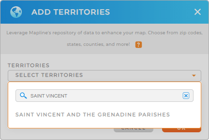
Start by adding a new territory from Mapline’s repository. Type even just a keyword VINCENT into the search bar and automatically, SAINT VINCENT AND GRENADICES PARISHES will appear. Choose that to add to your map.
How fast was that?


Pro Tip: Mapline’s extensive repository of territory boundaries empowers you to combine regions from Caribbean countries including Saint Vincent and Grenadines Parishes into your map, allowing you to find the most effective approach for business strategies.
CHOOSE PARISH COLORS
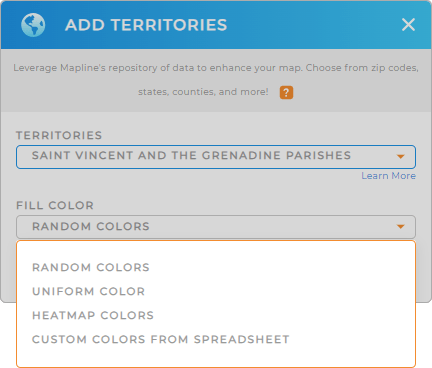
Customize your territory map with colors to unlock a wealth of insights at a glance. Color-coding your parish map not only enhances the visual distinction between regions. It also helps to transform your analysis into a vibrant tableau of information. Elevate the quality of your data visualization with colors while enriching your analytics, allowing you to capture hyper-focused insights with remarkable clarity.
Achieve that by choosing your desired color styling, then click OK.
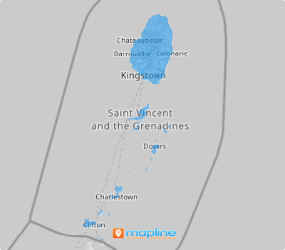
Wow! You’ve just created a powerful parish map! Go ahead and start analyzing your data and see how easy it is to identify insights for informed decisions.

GET NEW TERRITORY INSIGHTS
Now, try applying these capabilities as you analyze your data on a map of Saint Vincent and Grenadines Parishes:
- Run data calculations to discover hidden patterns and trends
- View territory report to extract insights and make informed decisions
- Spot flourishing markets with demographic map overlays


