SENEGAL DEPARTMENTS
- Territory Guide
- SENEGAL DEPARTMENTS
Revolutionize territory management by adding Senegal departments to your demographic map! Streamline your sales and marketing operations by analyzing customer distribution across these department areas. Imagine the increased engagement and conversion rates when you tailor your marketing campaigns to specific boundaries. By visualizing key insights on a department territory map, you set the stage for significant improvements in your operational efficiency and overall effectiveness.
Get ready to see your strategies come to life with sharper focus and greater impact.
WHAT ARE SENEGAL DEPARTMENTS?
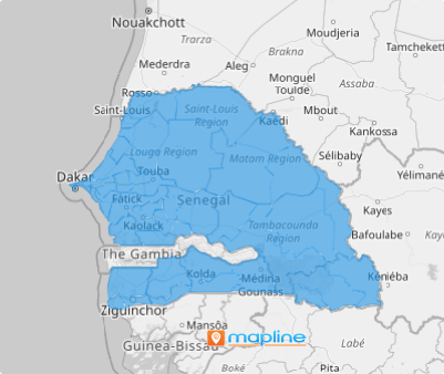
Senegal is a West African country divided into 46 departments. Keur Massar was the latest department added in May 2021. Each department has its own regional strength and economic activities. Mapping within these boundaries unlocks powerful geographic insights that can instantly elevate your business strategy.
See the story behind the numbers, spot opportunities, and make confident decisions about where to focus your energy and resources. Or, at a glance, you can identify departments with lower performance. This enables you to develop targeted marketing campaigns to boost your sales performance in those areas.
How convenient is that?
ADD SENEGAL DEPARTMENTS
By adding the department territory to your map of demographic data, you can instantly visualize potentials as well as the opportunities within each department. This laser-focus analysis allows you to weigh in on your next steps as a business leader and craft better solutions to improve your operations.
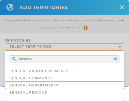
Adding department boundaries to your map is so easy you can do it in a few clicks! First, add a new territory from Mapline’s repository. On the search bar, type SENEGAL. Then, select SENEGAL DEPARTMENTS from the selection.
And that’s how you add territories to your map!


Pro Tip: Take your location insights to the next level when you leverage Mapline’s territory repository. Break down your analysis by Senegal departments, Senegal communes, Senegal regions, and Senegal arrondissements, to reveal the insights you need to streamline your analysis.
CHOOSE DEPARTMENT COLORS
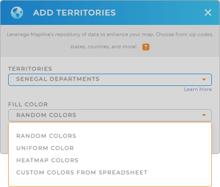
But don’t stop there. The next step is to fill out territory colors. Color-coding the Senegal departments is vital for enhanced data visualization. Colors help you identify key metrics at a glance. Imagine in just a few seconds, you can identify regional trends, performance metrics, and underperformed areas. How awesome is that?
Mapline makes it easy for you to choose color styling that helps you pinpoint critical data points and streamline your analysis process.
When you’re done configuring your color setting, click OK to complete the process of adding Senegal departments to your map.

GET NEW TERRITORY INSIGHTS
Ensure the best experience when analyzing data on a map of Senegal departments as you add these capabilities:
- Add a new dataset to uncover new data context
- Track and analyze competitors to gauge potential competitive threats and opportunities
- Run advanced calculations to unveil new insights about your brand


