SLOVAKIA DISTRICTS
- Territory Guide
- SLOVAKIA DISTRICTS
Add Slovakia districts to your map and unlock the full power of district-level analysis! With a district territory map, you gain the ability to dive deep into the factors impacting your business. By overlaying district boundaries onto your data map, you can conduct a thorough competitor analysis, pinpointing opportunities to outmaneuver the competition and fortify your sales and marketing efforts. Best of all, creating a map with these district boundaries is so straightforward that you’ll have it ready in no time. This simple step could be the game-changer your business needs to reach new heights.
Creating a map with district boundaries is so easy, you’ll be done before you know it!
WHAT ARE SLOVAKIA DISTRICTS?
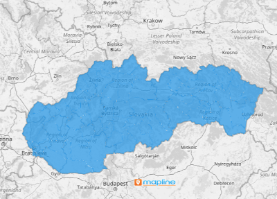
Slovakia, a landlocked country in Central Europe, is divided into 79 districts, each offering a unique perspective on the local market. The clearly defined geographic boundaries on a district map are crucial for uncovering valuable insights that can drive your business forward.
Imagine, as a sales manager, being able to leverage a map of Slovakia’s districts to visualize the competitive landscape. With this map, you can see exactly where your competitors are located and how close they are to your business. It’s like holding a magnifying glass over the market, revealing the fine details of your market share in comparison to your competitors. This level of insight is invaluable for making strategic decisions that can propel your business to the next level.
ADD SLOVAKIA DISTRICTS
Gain a competitive edge as you leverage these insights to develop strategies to put your brand on top of the curve of the competition! Get almost instant access to the necessary competitive analysis and bring those insights as you develop new strategies and capture market share.
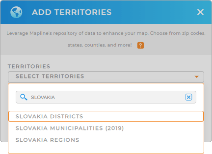
First, add a new territory from Mapline’s repository. Type SLOVAKIA into the search bar, and select SLOVAKIA DISTRICTS.
Wow, you’ve just added the right territory to your map! Now, let’s learn how to quickly color-code your district territory map.


Pro Tip: Mapline offers a diverse range of territory boundaries beyond Slovakia districts, including Slovakia regions and Slovakia municipalities. Explore these boundaries to customize your maps and sharpen your analysis!
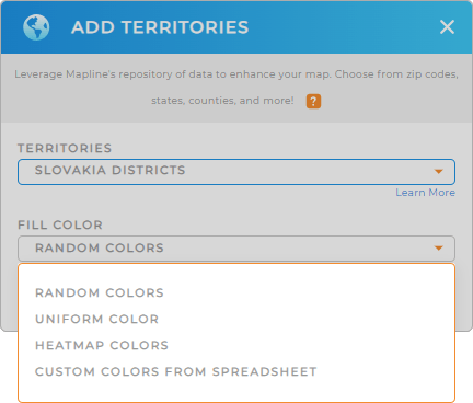
CHOOSE DISTRICT COLORS
Utilizing colors in a map of district boundaries produces visual clarity, effective presentations, and data-driven decisions. Applying static colors to your district territories makes your map more engaging and easier to understand. It is ideal if you want to present territory assignments to sales teams. On the other hand, you can visualize your data using dynamic colors. Get ready to spot growth opportunities at a glance!
Once you have configured your desired color styles, click OK.
That was fast! Have you even realized you’re done adding Slovakia districts to your map?

GET NEW TERRITORY INSIGHTS
Now, get the full advantage of using your map to extract more insights for business growth by leveraging these capabilities:
- Filter your data to get the most out of your visualizations
- Automate rep assignments to keep travel costs down
- Experience the sharing options that are more advanced than Google


