SLOVAKIA MUNICIPALITIES
- Territory Guide
- SLOVAKIA MUNICIPALITIES
Analyzing geographic insights on a map of Slovakia municipalities gives you a detailed, ground-level view of the local market, allowing you to see the landscape with new clarity. This map isn’t just a visual aid—it’s a rich source of information that offers precise insights to help you craft more effective business and marketing strategies. Whether you’re aiming to strengthen your sales approach or deepen your customer connections, municipality-level data analysis is where it all begins. By diving into this granular view, you unlock the potential to refine your strategies and make impactful decisions that resonate with your audience.
Map out these local government areas and be amazed by the results you gain as you transform your analytics to capture fresh insights that drastically improve your business!
WHAT ARE SLOVAKIA MUNICIPALITIES?
Slovakia, nestled in the heart of Europe, boasts a remarkable 2,891 municipalities, each with its own distinct character and potential. With one of the fastest-growing economies in Europe, it’s no surprise that more organizations are turning to municipality maps for their analysis. Create a map of Slovakia municipalities and see beyond points on a map—you’re revealing intricate connections that lead to sharper insights and smarter decisions.
Utilize a map of Slovakia municipalities to strengthen your localized market analysis. Imagine being empowered to understand the unique characteristics of each municipality, and identify hyper-local trends and consumer behaviors!
ADD SLOVAKIA MUNICIPALITIES
No more hit or miss when crafting strategies for your business marketing! With a municipality map, you can immediately identify factors relevant to your business. Make them the focal point when you craft strategies that cater to the needs of your target market!
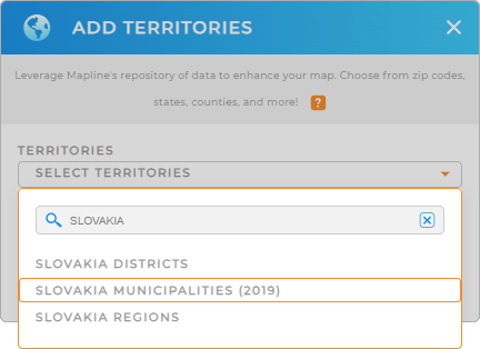
Adding a new territory from Mapline’s repository is so easy you’ll be done in a few seconds, First, type SLOVAKIA into the search bar, and select SLOVAKIA MUNICIPALITIES.
We’re done with Step 1, let’s quickly move on to Step 2.


Pro Tip: Mapline’s worldwide territory repository makes it possible for you to add Slovakia boundaries including Slovakia districts, Slovakia municipalities, and Slovakia regions.
CHOOSE MUNICIPALITY COLORS
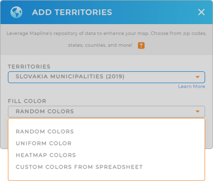
Step 2 is applying colors to your district territory. Incorporating territory colors allows you to quickly interpret your data. By color-coding your municipality map, you can easily distinguish areas, emphasize key data points, and reveal trends that may have been previously hidden. Make your map of Slovakia municipalities a powerful tool for decision-making and strategic planning!
Simply fill your territory with the color styling relevant to your type of analysis. Whether you choose random colors, uniform color, heat map, or custom colors, you can get more valuable insights in a color-coded district map! Click OK once you have configured your color setting.
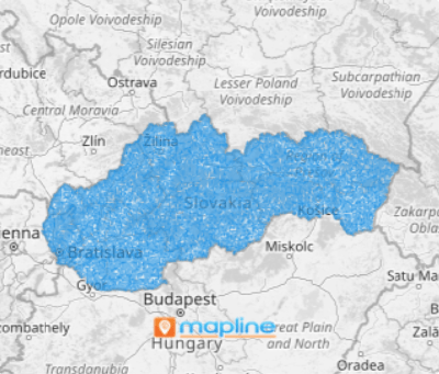
That’s how easy it is to add Slovakia municipalities to your map!

GET NEW TERRITORY INSIGHTS
With your new map in tow, you can extract more valuable insights when you apply these powerful capabilities:
- Optimize routes to fine-tune your trip factor
- Gain data insights when you calculate key metrics with Mapline Data
- Seamlessly incorporate new locations into your analytics and strategic planning


