SLOVENIA MUNICIPALITIES
- Territory Guide
- SLOVENIA MUNICIPALITIES
Leverage a map of Slovenia municipalities as you visualize your business operations to acquire the necessary insights needed to strengthen your business and marketing strategies! When you dive into municipality-level analysis, it’s like zooming in with laser focus—seeing things others might miss. Suddenly, those local demand patterns that seemed blurry come into sharp focus, giving you a clear path to success. This is no ordinary approach; it’s a bull’s eye strategy that zeroes in on what truly matters. By understanding these hyper-focused insights, you’re not just improving your business efficiency—you’re transforming it, making your operations smoother, your customers happier, and your impact stronger.
Skyrocket your strategies as you add these local administrative boundaries to your map today!
WHAT ARE SLOVENIA MUNICIPALITIES?
Slovenia, a gem in Central Europe, is divided into 212 municipalities, each representing a unique slice of the nation’s landscape. Of these, 12 hold urban status, serving as key hubs of activity and opportunity. These municipalities aren’t just lines on a map—they’re powerful tools for businesses looking to stay ahead of the curve. Most brands wisely leverage these boundaries to analyze their data, allowing them to anticipate challenges and make swift, informed decisions.
By understanding and utilizing the municipal divisions of Slovenia, businesses can navigate the complexities of the market with precision and foresight.
ADD SLOVENIA MUNICIPALITIES
The potentials are boundless once you start analyzing your strategies on a municipality map. Start performing an in-depth analysis and understand connections and patterns at a glance!
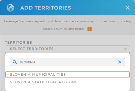
Adding a new territory from Mapline’s repository is so easy you’ll be finished before you know it! Simply type SLOVENIA into the search bar, and select SLOVENIA MUNICIPALITIES.
Wow, that was fast!


Pro Tip: If your business expands to Slovenia, Mapline’s worldwide territory repository allows you to add Slovenia statistical regions and municipalities seamlessly. Enhance your territory analysis by adding different boundaries to your map to run detailed analytics and capture insights for data-driven decisions.
CHOOSE MUNICIPALITY COLORS
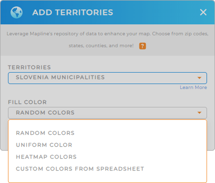
Now, visualize specific geographic areas as you apply territory colors. Colors make it so much easier to understand your data story within those boundaries. Tap into new insights you never knew existed as you apply static or dynamic colors.
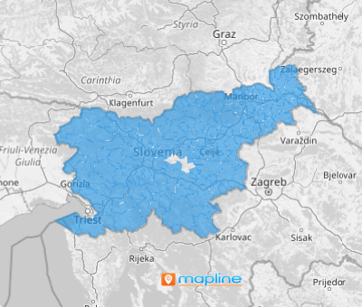
Just add your desired color styles then click OK to wrap up the process. Now, there’s your map of Slovenia municipalities!

GET NEW TERRITORY INSIGHTS
Now, streamline your data analysis even further as you leverage these powerful capabilities to your map:
- Analyze competitors to remain a step ahead in your industry
- Run distance calculations on your data to uncover anything you want to know about your business operations
- Draw radius circles to analyze areas with high concentration of sales


