SURINAME DISTRICTS
- Territory Guide
- SURINAME DISTRICTS
Harness the true power of a map of Suriname districts. Make it an arsenal of insights as you understand complexities within each district boundary. Many leading brands have already discovered the power of this approach, using it to outmaneuver their competitors and establish a strong, lasting presence in the market. By understanding the unique dynamics at play within each district, you’re equipped to make smarter, more informed decisions that drive success.
If this is what you’re looking for, then you’re in for a treat! Here at Mapline, you get to visualize your locations and customers in an instant! And the best part is that you can achieve all that by adding Suriname districts to your map in seconds. Let’s start now!
WHAT ARE SURINAME DISTRICTS?
Suriname, a lush tropical gem in South America, is divided into 10 unique administrative districts, each overseen by a district commissioner. These districts are more than just geographical boundaries—they’re opportunities waiting to be discovered. Savvy brands are already diving into district-level mapping to unlock the hidden potential within these regions, using this powerful tool to identify the best areas to expand their brand presence.
Whether your goal is to strengthen customer loyalty or to spread your wings and tap into new markets across neighboring districts, this kind of detailed analysis is your ticket to uncover insights you might have never imagined. If you’re ready to take your business to new heights, district-level mapping in Suriname is the exceptional approach that can help you get there.
ADD SURINAME DISTRICTS
Be empowered to define and visualize district areas, making it easier to analyze insights within these boundaries.
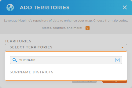
To add a new territory from Mapline’s repository, simply type SURINAME into the search bar, and select SURINAME DISTRICTS.
How easy was that!


Pro Tip: Mapline’s repository has an astonishing array of territory boundaries that allows you to analyze your data using different territories from countries across the globe including Suriname districts.
CHOOSE DISTRICT COLORS
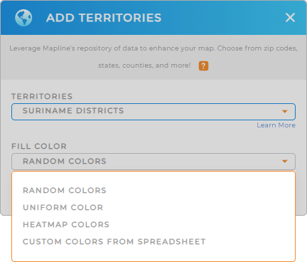
Now, hone in on more valuable insights as you leverage colors to your district territory. Colors are so powerful that they help ignite ideas so you can analyze your data in minutes rather than days or weeks! How awesome is that?
To do that, configure your color styles, then click OK.
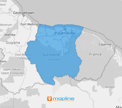
Now, there’s your map of Suriname districts ready to be explored and analyzed.

GET NEW TERRITORY INSIGHTS
Leverage these advanced capabilities to your map of Suriname districts and get ready to tap more insights at a glance:
- Stay ahead of your rivals as you make competitor analysis
- Build your first customer and market map
- Segment your audience based on district data for more targeted marketing campaigns


