SWEDEN COUNTIES
- Territory Guide
- SWEDEN COUNTIES
Leveraging a map of Sweden counties to your analysis is an intelligent move to scrape hidden insights and apply them in strategic planning and optimized operations. The county-level spatial analysis empowers you to strengthen your market understanding and identify investment opportunities. When you’re aiming to build a business that stands strong against any challenge, you need more than just sheer force—you need strategic brilliance! Imagine having the power to uncover hidden insights that propel your business forward with the precision of a superhero’s finest moves. That’s exactly what you achieve when you leverage a map of Sweden’s counties in your data analysis!
Here in Mapline, not only can you create a map of counties. More than that, you can create a map of counties with an impact in just a few seconds!
WHAT ARE SWEDEN COUNTIES?
Sweden, a vibrant Nordic country in Europe, is divided into 21 distinct counties, each with its own unique landscape of opportunities. When you incorporate county-level data analysis into your strategies, you’re not just gathering information—you’re unlocking a treasure trove of insights that can drive your business forward in leaps and bounds. Imagine being able to analyze the socio-economic factors within each specific county, allowing you to pinpoint exactly where the next big investment opportunity lies.
Want to supercharge your marketing strategies? Then add these county boundaries to your map now! With this level of precision, your strategies won’t just keep up with the competition—they’ll lead the way.
ADD SWEDEN COUNTIES
Generate a map of Sweden counties in seconds! Once your county map is generated, go ahead and start your county-level data analysis! After all, it only takes a few seconds to build a map:
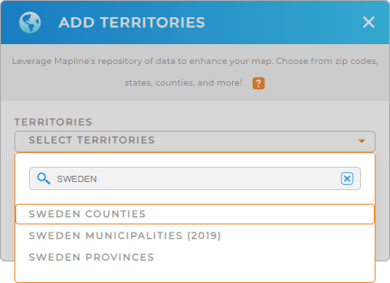
Step 1 is to add a new territory from Mapline’s repository. Type SWEDEN into the search bar, and select SWEDEN COUNTIES.
We’re almost done. One more quick step to follow before your map is complete.


Pro Tip: Access Mapline’s extensive list of territory boundaries, to add territories to your map including Sweden counties, Sweden municipalities, and Sweden provinces. Brace yourself for deep insights that you’ll gain when you leverage these territories to your analysis to enhance your business operations and achieve greater success.
CHOOSE COUNTY COLORS
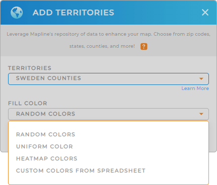
The next step is to customize your map with colors to speed up your analysis! Color-coding your map makes it easier for you to visualize trends and patterns at a glance.
Suppose you’re managing sales teams. You can add static colors to present territory assignments by the sales team. You can also color-code your territories based on your data to gain valuable location-based insights to enhance your sales strategies.
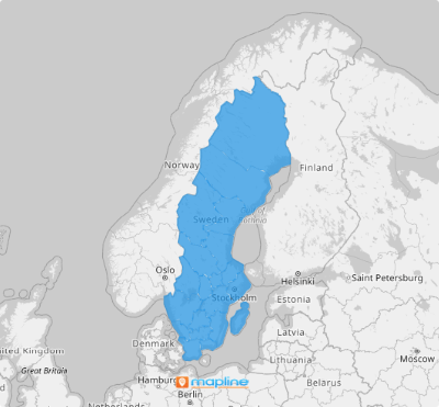
Apply your preferred color styles. Lastly, click OK. And that’s your map of Sweden counties with an impact!

GET NEW TERRITORY INSIGHTS
Hone in on new insights as you apply these capabilities to your map of Sweden counties:
- Automate daily routes
- Keep your sales team ahead with spot-on sales forecasts
- Compare competitor locations with Mapline Data


