TANZANIA REGIONS
- Territory Guide
- TANZANIA REGIONS
It’s time to add Tanzania regions to your map! Region-level mapping unlocks valuable insights, helping you identify opportunities to fine-tune your strategies for maximum impact. By analyzing in a region-specific level, you can adapt your approach to meet local needs and trends, setting the stage for long-term success with strategies tailored to each unique area. Understand more about risks and competitive landscapes by analyzing your data on a detailed regional map. This approach allows you to see trends and opportunities that might otherwise go unnoticed, enabling you to make smarter, data-driven decisions that drive success.
Let’s guide you on how to add these regions to your map on the fly!
WHAT ARE TANZANIA REGIONS?
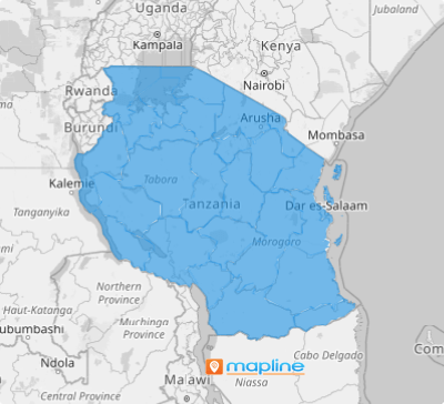
Tanzania is located in East Africa’s Great Lakes region. It comprises 31 regions, the primary administrative divisions of the country – 26 regions on the mainland and 5 in Zanzibar. Zanzibar is an Indian Ocean archipelago just off the mainland coast. It includes numerous small islands and two main islands, adding to Tanzania’s geographic diversity. In 2016, the Songwe Region was established, making it the latest addition that further refined the country’s administrative structure.
A map of Tanzania’s regions is a powerful tool for visualizing business insights. Within seconds, you can use it to dive into your analysis and uncover valuable patterns. This territory map adapts to various contexts, whether you’re crafting new marketing strategies, optimizing routes, or pinpointing growth opportunities.
ADD TANZANIA REGIONS
Swiftly add Tanzania regions to your map for better analysis. Incorporate regional boundaries to significantly enhance your ability to analyze regional market trends or manage sales territories. It empowers you to unlock key insights needed to refine your business strategies, identify opportunities, and drive business growth.
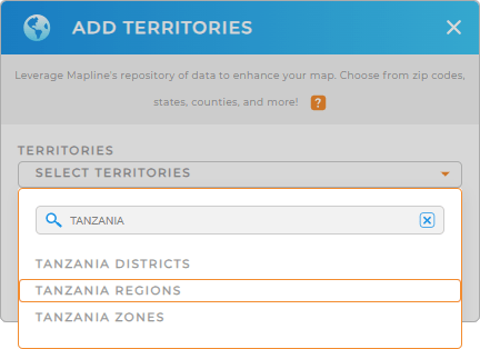
Mapline allows you to add a new territory from Mapline’s repository in just a few clicks. Type TANZANIA in the search bar and choose to add TANZANIA REGIONS to your map.
One final step and you’ll be adding Tanzania regions in no time.


Pro Tip: Easily add Tanzania territory boundaries including Tanzania regions, Tanzania districts, and Tanzania zones when you access Mapline’s extensive list of territory boundaries. It provides hundreds of territories from all over the world to help you unlock powerful new insights.
CHOOSE REGION COLORS
It’s time to perfect your custom territory color styling! Thoughtful color choices can transform your map into a visually compelling, data-driven story that resonates with your audience. For instance, when analyzing population density to pinpoint focus areas, dynamic color gradients bring your data to life, automatically updating to reflect real-time insights. With the right colors, you can create an engaging, informative map that makes complex data easy to understand and act upon.
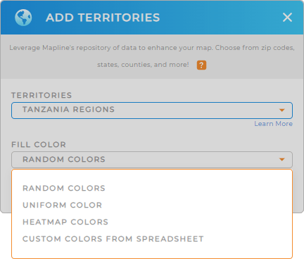
Choose from Mapline’s list of smart color styling options. Once you have configured your settings, click OK.
Now that you have created a map of Tanzania regions, what’s next?

GET NEW TERRITORY INSIGHTS
With these powerful capabilities, take your analytics up a notch!
- Draw custom shapes to get an in-depth analysis of your data within a given radius
- Segment your data to drill down and reveal more insights
- Customize your maps to tell data stories with style


