TANZANIA ZONES
- Territory Guide
- TANZANIA ZONES
Supercharge your analytics by leveraging a map of Tanzania zones. Visualize essential factors affecting your business within these specific boundaries to reveal hidden insights that can empower you to tailor business strategies to hyper-local markets and gain a competitive edge. This tool is perfect for brands aiming to refine sales and marketing tactics or streamline logistics. Be wowed by zone-level mapping to better understand your customer preferences and behaviors, allowing for data-driven decisions that align with your customer expectations.
Set up this specialized territory in seconds and start unlocking insights immediately! Here’s how to get started.
WHAT ARE TANZANIA ZONES?
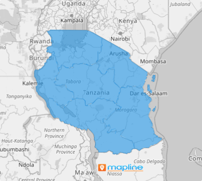
Tanzania is a country located in East Africa. Its 31 regions are grouped into seven zones. Understanding zone areas is integral for many brands doing territory analysis and planning. For example, Zanzibar zone is a tourism destination while the Coastal zone is where the coconut business flourishes. Looking at your data within these regions provides a different angle of understanding regional dynamics that can transform your business.
Brands operating across multiple regions can greatly benefit from a zone territory map, as it offers deep insights into how data performs within each zone. This level of analysis helps uncover unexpected trends—like identifying that your brand campaign resonates more strongly in some areas than others. By understanding the unique needs of each zone, you can fine-tune your strategies and maximize marketing impact where it matters most, ensuring your efforts are as effective and targeted as possible.
ADD TANZANIA ZONES
Elevate your strategic vision by layering zone boundaries onto your map—spot new opportunities, unlock regional potential, and design agile strategies tailored to each market’s unique needs.
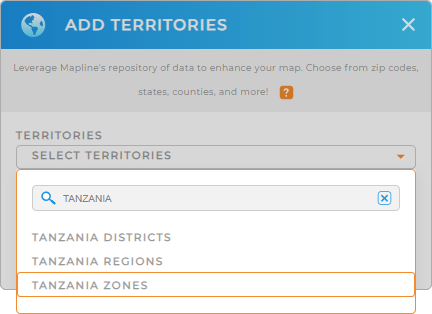
To get started, first, add a new territory from Mapline’s repository. Simply type TANZANIA into the search bar. Select TANZANIA ZONES to add to your map.
Wow, that’s pretty fast!


Pro Tip: Mapline’s worldwide repository of territory boundaries includes Tanzania districts, Tanzania regions, and zones to fit your territory analysis to make more strategic decisions.
CHOOSE ZONE COLORS
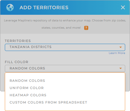
Need to identify trends? Worry no more because Mapline got you covered! Just fill the territory colors with the color styles of your choice and watch your map reveal trends and patterns like never before!
Make your zone map a powerful tool for decision-making and strategic planning as you apply your preferred color styling – random colors, uniform color, custom colors, and heat map.
Once you have configured your color setting, click OK so you can start exploring insights from your map.

GET NEW TERRITORY INSIGHTS
What else can you do with your map of Tanzania zones? A lot more! Turbocharge your analysis as you leverage these powerful capabilities:
- Generate advanced route optimization to cut back mileage
- Seamlessly incorporate new data in seconds
- Add a new report to hone in on the most relevant insights in your data


