THE BAHAMAS DISTRICTS
- Territory Guide
- THE BAHAMAS DISTRICTS
Add The Bahamas districts to your map, and prepare to unlock a whole new level of insights! By incorporating district-level analysis into your strategy, you’re not just adding a few more lines to a map—you’re opening the door to a treasure trove of information. This detailed approach can reveal hidden opportunities, optimize your operations, and fine-tune your marketing efforts for maximum impact. Imagine being able to target your strategies with pinpoint accuracy and boost your business growth like never before.
Ready to take your strategic planning to new heights? Dive into the potential of The Bahamas districts on your map and discover how this powerful tool can transform your approach and drive unparalleled success. Let’s get started!
WHAT ARE THE BAHAMAS DISTRICTS?
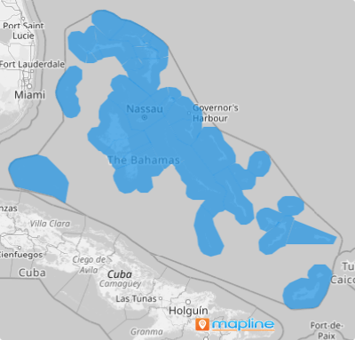
The Bahamas, an island paradise nestled within the Lucayan Archipelago of the Atlantic Ocean, is more than just a collection of stunning tropical islands. With 700 islands divided into 31 distinct districts, this vibrant region offers a rich tapestry of opportunities and challenges. When you map out these districts, you’re not just drawing lines—you’re unlocking a detailed blueprint of the market.
Imagine being a tourism company with this district-level map at your disposal. You’d gain an unparalleled understanding of local market conditions, consumer behaviors, and the socio-economic factors shaping each district. This level of insight is like having superpowers for your business strategy, allowing you to tailor your products and services with precision. By diving deep into these district details, you can craft offerings that resonate with the unique needs and preferences of customers across different areas.
Ready to transform your approach and seize new opportunities? Let’s explore how a district territory map of The Bahamas can elevate your business strategies and drive success in ways you’ve never imagined.
ADD THE BAHAMAS DISTRICTS
Quickly visualize the impact of local trends and patterns on your brand! With the powerful visualization from your district map, who needs sleepless nights combing through the rows and columns of spreadsheets?
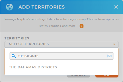
Make your district-level analysis easier by adding a new territory from Mapline’s repository, type THE BAHAMAS into the search bar, and select THE BAHAMAS DISTRICTS.
Wow, that’s lightning fast! Now, let’s move on to the last step.


Pro Tip: Custom maps with The Bahamas districts using Mapline’s Territory Repository provide a detailed and visual representation of your operational landscape.
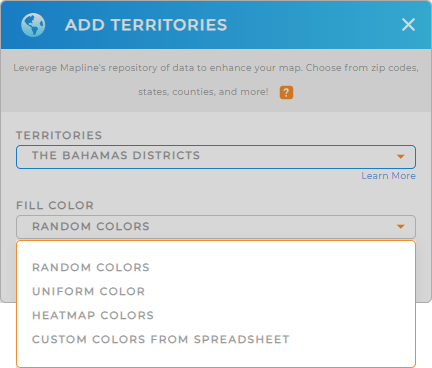
CHOOSE DISTRICT COLORS
When customizing the appearance of your district territory map, it’s important to determine how each district is visually represented. Adding color styling lets you seamlessly analyze seasonal trends and peak tourist times for each district. A color-coded map is a vital tool to develop new strategies to attract visitors during off-peak seasons. If you’re leaning into this type of analysis, choose heat map colors for their clear color gradient.
Once you have configured the best color styles, you will gain more insights for informed decisions that drive overall business growth.

GET NEW TERRITORY INSIGHTS
Leverage the following powerful capabilities to unlock hidden insights to help enhance your business operations:
- Supercharge your brand with powerful automations that revolutionize your workflow and accelerate growth
- Add a new chart to display the exact information you need
- Add metrics to make data-driven decisions


