TONGA DISTRICTS
- Territory Guide
- TONGA DISTRICTS
Get ready to supercharge your data analysis as you leverage a map of Tonga districts. Mapping location data and district boundaries works wonders for many brands. By leveraging a district map, they can understand hyper-local trends, customers’ buying behaviors, and market dynamics. This map produces a powerful data visualization that lets you glean insights to position you on a strategic edge of the competition.
Mapline makes it so easy to add Tonga districts to your map, it only takes less than a minute. Check it out!
WHAT ARE TONGA DISTRICTS?
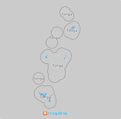
Tonga is a Polynesian country consisting of 23 districts. If you’re in the tourism business, leveraging a district map is crucial to identifying factors pertinent to planning tourism initiatives including beach resort development, surfing, whale watching, and more! If you’re looking for an effective way to convey key information about each district, then you’re in for a treat!
Start a district-level analysis to reveal hidden gems within each district. Make your district map a dynamic narrative that caters to your markets’ needs.
ADD TONGA DISTRICTS
Be a groundbreaker in your industry as you identify key data points on a map of Tonga districts! Imagine the power to identify regional patterns, analyze trends, or gain customer insights is in your hands. Immediately apply these newly discovered insights to your strategies to catapult your business to success.
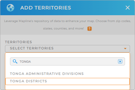
To create a powerful visualization, add a new territory from Mapline’s repository. In the search bar, type TONGA and select TONGA DISTRICTS from the selection.


Pro Tip: Access Mapline’s repository of territory boundaries to add both the Tonga administrative divisions and the districts of Tonga to your map. Explore other territories from different countries in the world including countries in Oceania to enhance your location analytics and drive the insights you need to achive more business success.
CHOOSE DISTRICT COLORS
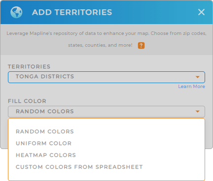
Let’s take your analysis up a notch as you apply colors. Make your data come alive with dynamic colors. Since they are connected to your data, they update in real-time so you can get the most current insights. How awesome is that?
Just choose your preferred color styling to match your level of analysis. Once you have configured your color style setting, click OK.
And that’s it! Now you can start analyzing your data on a map of Tonga districts.

GET NEW TERRITORY INSIGHTS
Adding Tonga districts to your map is just the start. Now, try adding these powerful capabilities to unlock more significant insights that were previously hidden in your data:
- Add labels to your map for clarity
- Edit and style your routes to get the utmost efficiency
- Generate intelligent sales forecasts to align your strategic business goals with real-time data


