UGANDA SUBREGIONS
- Territory Guide
- UGANDA SUBREGIONS
Unlock your business’s full potential with a dynamic map of Uganda subregions, turning location insights into a game-changing advantage. This powerful tool keeps you ahead of the curve, enabling you to foresee challenges and take bold, decisive action. With subregion boundaries—the most detailed administrative divisions in the country—you gain razor-sharp insights into local markets, empowering you to tailor your strategies with pinpoint precision. Meet the unique needs of your market in each subregion, fuel unstoppable growth, and dominate your market like never before.
In just a few seconds, you can uncover key patterns and factors critical for smarter planning and decision-making, giving you a clear edge in strategy and execution. The path to hyper-local success starts here!
WHAT ARE UGANDA SUBREGIONS?
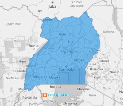
Uganda, the vibrant heart of East Africa, is divided into 15 dynamic subregions. These subregions under the Uganda Local Governments Association (ULGA), work seamlessly with the national government to empower local communities and drive development across the nation. Subregion boundaries, as the smallest administrative divisions, offer a closer, more precise view of the markets you serve. This isn’t just about numbers; it’s about understanding real people and their unique needs.
Something transformative happens when you visualize your data on a map of Uganda’s subregions. It’s more than just mapping—it’s gaining the foresight to anticipate challenges before they arise. With this granular insight, you can craft strategies that resonate with hyper-local demands.
ADD UGANDA SUBREGIONS
Add subregion boundaries on a map to unlock a powerful visual tool that simplifies planning and decision-making. When your business aligns with the heartbeat of the local market, you don’t just succeed—you thrive.
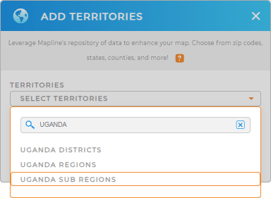
The best part? It’s quick and seamless. With just a few clicks, you can add a new territory from Mapline’s territory. Type UGANDA in the search bar and select UGANDA SUB REGIONS.
With the right territory selected, you’re one step ahead of gaining a crystal-clear picture for your next big business breakthrough!


Pro Tip: Mapline’s Repository is an extensive library of hundreds of territory boundaries including Uganda districts, Uganda regions, and subregions, that puts actionable insights right at your fingertips. transforms your information into powerful visualizations.
CHOOSE SUBREGION COLORS
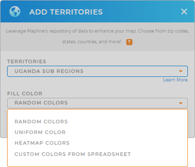
Custom territory styling takes your map to the next level, combining visual appeal with data clarity. By transforming your map into an engaging visual story, you’ll empower yourself to make informed, strategic decisions that drive impactful results.
Whether you choose random colors, uniform shades, heat maps, or custom colors, the right color styling highlights critical information with ease. It’s not just about making your maps look great—it’s about simplifying complex data for faster, more accurate insights!

GET NEW TERRITORY INSIGHTS
Now, utilize these advanced capabilities to capture deeper insights and make more informed decisions that drive success in your planning and strategy efforts across Uganda:
- Customize charts to create the ultimate canvas for visualizing key metrics
- Add center of minimum distance to your map to minimize mileage and identify travel challenges
- Create sales reports to give you the competitive edge to outshine the competition


