UKRAINE DISTRICTS
- Territory Guide
- UKRAINE DISTRICTS
Uncover location-based insights when you add your business insights on a map of Ukraine districts. Analyzing on a district level provides a clearer insight into regional demographic patterns and trends that drive customized strategies for each district’s needs. Visualizing different perspectives on a district map ignites ideas and helps you make informed decisions for market penetration, optimizing logistics, or resource allocation.
Ready when you are, let’s take a look into adding this territory to your map quickly.
WHAT ARE UKRAINE DISTRICTS?
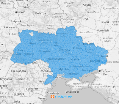
Ukraine is a European country divided into 136 districts. Turn a simple district map into a powerful data visualization tool with an impact! Discover location-specific insights by mapping district boundaries and immediately identify how key inisights interrelates with their boundaries in different ways.
If you’re a wholesaler or a distributor, leveraging a map of Ukraine districts can enhance your operational efficiency and decision-making. You can use the map to execute your most efficient plan of delivery routes to save time and money.
ADD UKRAINE DISTRICTS
Utlize a map of Ukraine districts as a focal part of your data analysis. Its powerful visualization is so impressive that you can identify high-potential areas and tailor your approach to meet local demands.
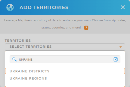
To add a new territory from Mapline’s repository, type UKRAINE into the search bar, and select UKRAINE DISTRICTS.
We’re almost done. There’s just one important step remaining.


Pro Tip: Mapline’s worldwide repository of territory boundaries enables you to add both Ukraine districts and Ukraine regions effortlessly. Be empowered to get hyper-focused insights as you run detailed analytics using different territory boundaries!
CHOOSE DISTRICT COLORS
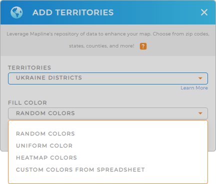
Now it’s time to fill your territory colors. To extract the best insights, customize your map by applying different color styles. Colors help capture key data points, interpret them, and act on them accordingly. For instance, you may want to apply heat map colors to identify the intensity in specific regions. It helps to identify hot spots and areas needing improvement.
Choose your preferred territory color styles from the great options provided: random colors, uniform color, heat map, and custom colors.
Lastly, click OK. Now, there’s your map of Ukraine districts!

GET NEW TERRITORY INSIGHTS
Level up your strategies as you apply these valuable capabilities when you analyze your data on a map of Ukraine districts:
- Make a competitor analysis to stay ahead of your rivals
- Get the most advanced data calculations to gain new insights
- Draw radius circles to understand locations with a high concentration of sales and optimize your outreach


