U.S. VOTING PRECINCTS
- Territory Guide
- U.S. VOTING PRECINCTS
A map of U.S. voting precincts is more than just a political tool—it’s a goldmine of local insights! Use it to unlock opportunities, connect with communities, and elevate your brand presence where it matters most. Mapping these boundaries allows you to visualize patterns, identify opportunities, and make strategic decisions with clarity and confidence. It’s all about turning data into impact and insights into action!
Leverage this powerful resource to fine-tune your strategies, connect with communities, and amplify your brand presence across Washington State. It’s the smart way to turn local knowledge into meaningful impact!
WHAT ARE U.S. VOTING PRECINCTS?
Casting a vote in the election is a big deal, especially for the engaged and passionate voters in Washington—Spokane County and Bexar County, TX is buzzing with energy! To keep this momentum rolling, mapping voting precincts is a game-changer! With Mapline’s handy territory boundaries for voting precincts, you can transform your map into a dynamic tool that makes navigating and organizing local elections easier than ever.
But wait, there’s so much more! With this detailed territory, you can craft hyper-local strategies to meet the specific needs of your customers. This level of analysis reveals patterns, uncovers hidden opportunities, and connects seemingly unrelated data points to provide a holistic view of your operations.
ADD U.S. VOTING PRECINCTS
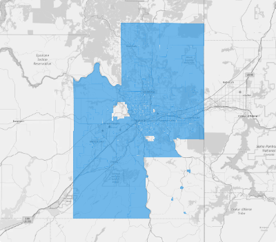
Add these special boundaries to your map today to assess your market potential, spot emerging trends, and uncover patterns that may have previously gone unnoticed. As you deepen your understanding of these territories, you can make strategic, informed decisions that fuel growth, boost operational efficiency, and solidify your competitive edge across Spokane County.
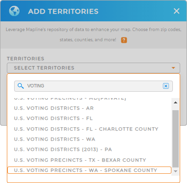
To add a new territory from Mapline’s repository. Just type VOTING PRECINCTS and it will lead you to choose U.S. VOTING PRECINCTS. Select either SPOKANE COUNTY, WA or BEXAR COUNTY, TX.


Pro Tip: Gain unparalleled local insights with Mapline’s repository! Dive into detailed territory data for voting precincts in Spokane, WA, and Bexar County, TX. Whether you’re analyzing trends or strategizing outreach, this data puts hyper-local precision right at your fingertips.
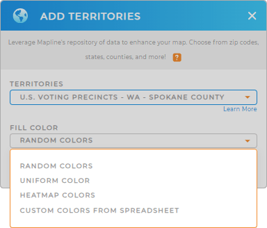
CHOOSE VOTING PRECINCT COLORS
Imagine watching your map come to life as colors shift to reflect changes in population density, sales performance, or resource distribution. This dynamic approach transforms raw data into vibrant stories, uncovering patterns and trends that static visuals simply can’t match.
Make the right choice of color styles and accelerate your decision-making, highlight opportunities, and provide actionable insights with stunning clarity.

GET NEW TERRITORY INSIGHTS
Get ready to be mind-blown as you manage to add these advanced capabilities on your analytical toolkit:
- Turn data into actionable insights and enhance data-driven delivery management
- Experiment with different versions of your territory map to find the best fit for your sales teams
- Add U.S. Demographic data to analyze trends


