VENEZUELA REGIONS
- Territory Guide
- VENEZUELA REGIONS
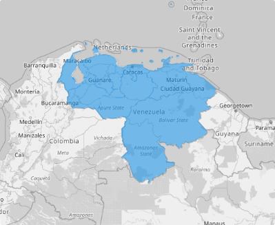
Unlock the power of a map of Venezuela regions as you dive into hidden patterns and uncover regional trends! A region-level analysis is the key to smarter, data-driven decisions. This comprehensive territory map provides a crystal-clear view of your operations, enabling you to spot opportunities, evaluate regional performance, and fine-tune your strategies confidently.
Imagine the possibilities: targeted outreach, optimized resource allocation, and strategies fine-tuned to meet the needs of specific regions. With region-level analysis at your fingertips, you can make informed decisions that drive performance and growth!
WHAT ARE VENEZUELA REGIONS?
Venezuela, perched at the northern tip of South America, is a land of vibrant culture and stunning natural beauty. To streamline local administration and foster regional development, the country is organized into nine administrative regions. These regions are thoughtfully grouped from Venezuela’s neighboring states, federal dependencies, and the bustling capital district, creating a framework that bridges local governance with national progress.
Visualizing the region boundaries can help transform insights into action and take your decision-making to the next level!
ADD VENEZUELA REGIONS
Ready to supercharge your analysis? Add Venezuela’s regions to your map in under a minute and transform it into a powerhouse of spatial intelligence. Gain the clarity you need to uncover hidden insights, sharpen your strategies, and drive smarter, more impactful decisions.
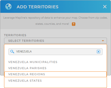
The path to better outcomes starts as you add a new territory from Mapline’s repository. Type VENEZUELA in the search bar and select VENEZUELA REGIONS.


Pro Tip: Take your territory analysis to the next level and unlock new opportunities with Mapline’s comprehensive territory repository. Add different territories to your map including Venezuela Venezuela states, Venezuela municipalities, Venezuela parishes, and regions, and tailor strategies to specific areas, empowering your business to thrive in a competitive landscape.
CHOOSE REGION COLORS
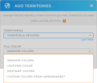
Elevate your map as you apply colors. A color-coded map brings your data to life, turning complex information into a vibrant, easy-to-read visual that highlights regional patterns at a glance.
Mapline provides different color styles. Assign distinct colors to your canton territories to effortlessly spot trends and develop strategies to enhance your business operations. You can also apply heat map gradients to pinpoint potential risks, giving you the foresight to plan proactively and stay ahead of the competition. It’s a straightforward yet powerful tool to transform raw data into actionable insights that drive success!

GET NEW TERRITORY INSIGHTS
Unlock deeper insights when you add these powerful capabilities into your analytics:
- Pinpoint underperforming locations to quickly assess the factors at play
- Incorporte metrics to easily measure success and identify areas for improvement
- Customize map pins to easily track and analyze competitor presence


