U.S. VIRGIN ISLAND ESTATES
- Territory Guide
- U.S. VIRGIN ISLAND ESTATES
Add Virgin Islands estates to your map and uncover the latest trends to help you craft a strong marketing approach and brand presence.
Whether you’re a real estate investor, urban planner, or environmental researcher, having a detailed territory map of U.S. Virgin Islands estates can be a game-changer for your brand. A rich territory map allows you to analyze estate locations, identify potential target areas, and make informed decisions about your next steps.
Unleash the power of location data and map your Caribbean success story now!
ADD VIRGIN ISLANDS ESTATES
Adding the Virgin Islands estates to your map opens limitless possibilities. Craft location-intelligent business plans, analyze estate trends, create highly-efficient routes, and so much more!
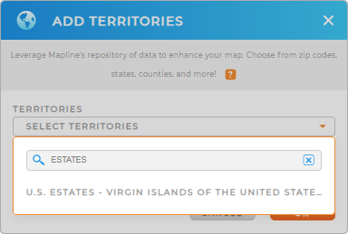
First, add a new territory from Mapline’s Territory, then type VIRGIN ISLANDS ESTATES into the search bar.
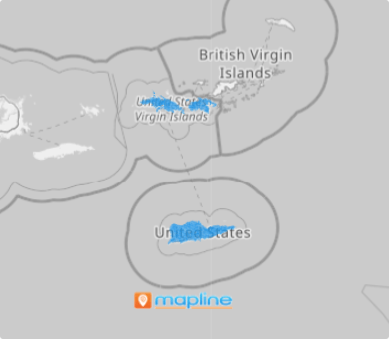
Click OK, and you’re halfway there. Woah, that’s fast!


Pro Tip: Mapline’s Repository provides the latest Virgin Island estate boundaries available from the U.S. Census Bureau. Select the most recent year from the drop-down to get the most recent boundaries.
CHOOSE ESTATE COLORS
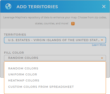
Style your territories with custom colors that speak volumes about your data.
Let’s say you’re a tourism agency illustrating target regions on your map. You can use static colors to represent popular destinations, historical sites, or leisure spots. Or, leverage dynamic styling to create a heat map that updates whenever your data changes.
Embrace the power of custom territory color styling and let your map tell a compelling story! Configure your settings, click OK, and watch your map transform into a detailed canvas ready to unveil key insights hidden within your territories.

GET NEW TERRITORY INSIGHTS
Mapline makes it quick and easy to add the U.S. Virgin Islands estate boundaries to your map. Here are some common ways that other brands use this terrtiory map to take their data analytics to the next level:
- Create strategic sales and marketing plans
- Enhance this territory with U.S. Demographic Data
- Leverage filters to analyze a focused target audience


