WALES PRINCIPAL AREAS
- Territory Guide
- WALES PRINCIPAL AREAS
A map of Wales principal areas offers a game-changing foundation for brands to dive deep into advanced location analysis. Make the best use of this map as it helps to transform how you manage your business and adapt to ever-changing markets. By leveraging a principal area-level analysis, you can supercharge your sales strategies with precise market segmentation and tailor marketing campaigns to regional preferences.
It’s the ultimate toolkit for staying ahead and thriving in a competitive landscape!
WHAT ARE WALES PRINCIPAL AREAS?
Wales, a country within the United Kingdom, boasts a diverse physical geography with a rugged coastline and a predominantly upland interior. For governance, Wales is divided into 22 unitary authorities, known as “principal areas.” These single-tier local government divisions were established in 1996 and are responsible for delivering a wide range of services, including education, social work, environmental protection, and highway maintenance.
Integrating principal area-level insights into decision-making unlocks a sharper understanding of regional differences in demographics, trends, and customers’ buying behavior. This detailed perspective empowers brands to respond swiftly to market changes, ensuring resources are strategically allocated to fuel growth and boost profitability.
ADD WALES PRINCIPAL AREAS
This principal area map is a powerful tool for uncovering connections within your locations. It sparks fresh insights that are crucial for informed business decision-making, helping you identify key opportunities and drive strategic growth.
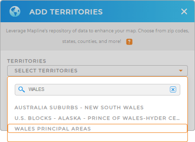
For starters, add a new territory from Mapline’s repository. In the search bar, type WALES to quickly select WALES PRINCIPAL AREAS.
Woah, that was fast!


Pro Tip: Mapline’s territory repository lets you add Wales principal areas and other territories from the United Kingdom, in seconds! Streamline your operations with a crystal-clear view of territories across the United Kingdom. These powerful maps uncover patterns that drive quicker deliveries, smarter routes, and sharper resource planning.
CHOOSE PRINCIPAL AREA COLORS
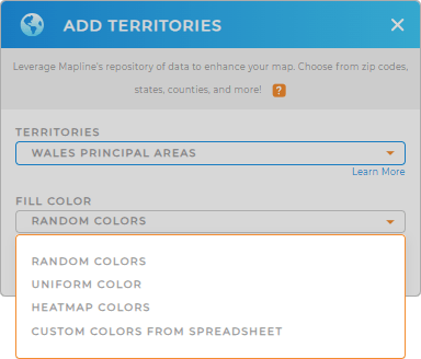
Now, let’s customize your territory map with strategic color coding to unlock powerful insights at a glance. By assigning colors to different regions, you create instant visual distinctions that sharpen your analysis and reveal hidden trends.
Elevate your map by choosing from the color styling options–heat map, random colors, uniform color, or custom colors. This is how you make your analytics not just clearer, but smarter.
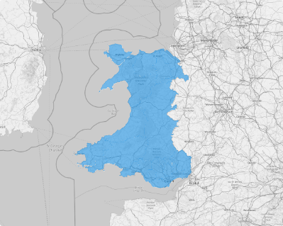
After you’ve configured your settings, click OK. Now, there’s your dynamic map of Wales principal areas!

GET NEW TERRITORY INSIGHTS
Explore these capabilities to get more insights from your analysis:
- Create eye-catching presentations that give the best insights
- Stay agile as you uncover your competitors’ market footprints
- Identify factors affecting your business in seconds


