ZAMBIA PROVINCES
- Territory Guide
- ZAMBIA PROVINCES
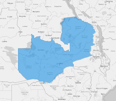
A map of Zambia provinces should be an integral part of your analytical toolkit. Not only does it provide a dynamic, detailed view of Zambia’s 10 provinces. More than that, it captures the essence of location intelligence, turning insights into opportunities. Imagine predicting shifts in demand, overcoming logistical hurdles, and uncovering growth opportunities—all while staying a step ahead of the competition! With province-level mapping, you’re not just navigating Zambia’s landscape—you’re shaping it!
Dive in to learn how this powerful approach can elevate your operations and drive lasting success.
WHAT ARE ZAMBIA PROVINCES?
Zambia, a landlocked nation at the heart of South-Central Africa, is administratively structured into ten provinces and 116 districts (as of 2018). At the provincial level, governance is led by a Provincial Minister appointed by the President. These ministers play a pivotal role in implementing government policies and ensuring seamless coordination among various government departments, fostering development and efficient administration across the regions.
Adding Zambia provinces to your map is your gateway to a deeper understanding of the unique market dynamics shaping success. With granular data at your fingertips, you can uncover specific opportunities and tackle challenges head-on within each region. This sharp focus empowers you to craft marketing strategies that hit the mark, engage customers like never before, and set your business on a path to extraordinary growth.
ADD ZAMBIA PROVINCES
Having a detailed map of Zambia provinces is your first step toward discovering the unique market dynamics shaping the country. With granular, detailed boundaries, you can easily identify specific opportunities and challenges within each province, empowering you to tailor your strategies as needed by your customers. M
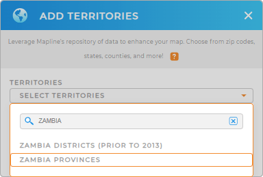
Let’s quickly add these province boundaries to your map now. Start by adding a new territory from Mapline’s repository. Then, in the search bar, type ZAMBIA and select ZAMBIA PROVINCES.
With the right territory, you’re now ready to take the next step.


Pro Tip: Unlock endless possibilities with Mapline’s repository, featuring detailed territories from Zambia, including Zambia districts and provinces. These insights are designed to take your data and territory analysis to the next level.
CHOOSE PROVINCE COLORS
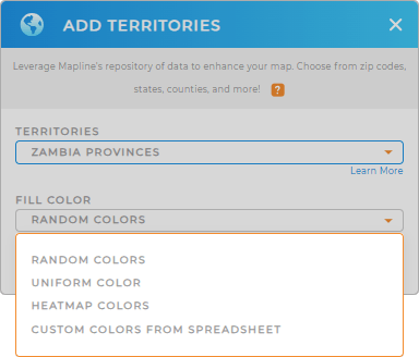
To take your analysis to the next level, explore the power of colors. Colors speed up decision-making, enhance clarity, and empower you to act with confidence.
Let’s harness the power of color to transform insights into action by choosing the best territory color styles and bring your data to life!
Once you’ve configured your color settings, click OK and get ready to discover the underlying trends in your Zambia province map.

GET NEW TERRITORY INSIGHTS
Now, you can uncover insights like never before as you make these powerful capabilities part of your analytical toolkit:
- Apply Mapline connectors to link Salesforce, Google Sheets, and other platforms into Mapline in seconds
- Strategically segment your market to target the right opportunities
- Access demographics or distance calculations with Mapline data


