COLOMBIA MUNICIPALITIES
- Territory Guide
- COLOMBIA MUNICIPALITIES
Harnessing the power of Colombia municipalities can revolutionize your brand’s analytics and operational efficiencies. These smaller administrative units offer a detailed view of local dynamics, enabling targeted marketing efforts, streamlined logistics, and enhanced customer engagement strategies.
For example, you can pinpoint high-potential target markets, optimize sales routes, and minimize mileage and other expenses. Embrace the potential of regional mapping and let’s create your map of Colombia municipalities now!
WHAT ARE COLOMBIA MUNICIPALITIES?
Colombia’s municipalities are fundamental administrative divisions overseen by local mayors and councils. They provide essential insights into regional characteristics and consumer behaviors. By mapping municipalities, you can precisely target micro-markets, refine service delivery, or optimize resource allocation. This level of granularity empowers strategic decision-making across various operational functions.
ADD MUNICIPALITIES
Integrating Colombia’s municipalities into your mapping strategy is a pivotal step towards comprehensive market understanding and operational optimization.
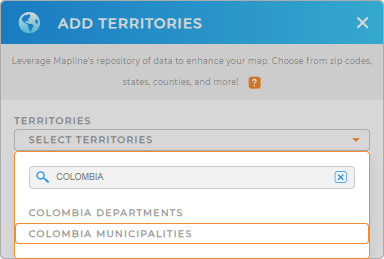
To add these regions to your map, simply add a new territory from Mapline’s repository. Type COLOMBIA into the searchbar and select COLOMBIA MUNICIPALITIES.
This quick step enables you to visualize and analyze departmental data, leading to more informed business decisions.


Pro Tip: Mapline’s extensive worldwide territory repository offers a broad range of territory boundaries including Colombia departments and municipalities. Add different boundaries to your map to explore different regional trends and enhance your strategic analysis capabilities.
CHOOSE MUNICIPALITY COLORS
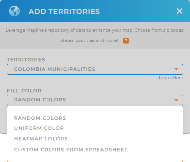
Applying color styles to Colombia’s municipalities on your map is a fantastic way to level-up your analytics. Get regional insights in a single glance and easily differentiate between key data points, such as high-potential target markets or regional demographics.
To customize your map, choose the type of color styling that best suit your needs, then click OK to finalize your selection.
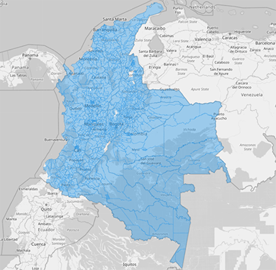
Now your map is ready to analyze! How amazing is that?

GET NEW TERRITORY INSIGHTS
Unlock a wealth of new insights with your Colombia municipalities map. Mapline offers powerful capabilities to help you delve deeper into your data:
- Visualize data density with heat maps to identify trends within municipalities to your map
- Segment consumer data within each municipality to tailor marketing campaigns and improve engagement strategies
- Conduct sophisticated distance calculations between municipalities to optimize logistical operations and service coverage


