PERU REGIONS
- Territory Guide
- PERU REGIONS
A map of Peru regions integrated into your analysis is your game-changing approach to stay ahead of the competition. By visualizing regional boundaries alongside your data, you unlock the power to optimize logistics and craft marketing strategies that pinpoint regional needs. Most successful brands leverage a region-level analysis to help them envision the most efficient routes and identify potential locations for new stores.
Expand your strategic advantage using a detailed region map. With this tool, you’re not just planning; you’re positioning your business for unmatched success. Ready to elevate your strategy? Start mapping your way to smarter decisions today!
WHAT ARE PERU REGIONS?
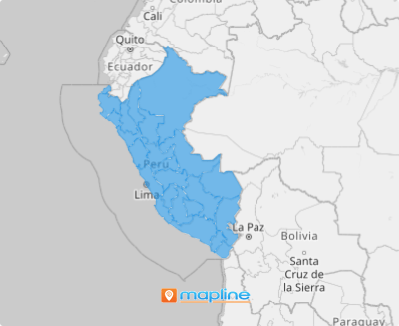
Peru, a megadiverse nation in South America, is divided into 25 regions, serving as its first-level administrative subdivisions. This includes 24 departments and the Callao Province, each operating as a regional government circumscription with its own Regional Government. This structure supports localized governance and administration, reflecting the country’s commitment to managing its diverse geography and population effectively.
Each region holds unique characteristics that can be a goldmine for shaping your marketing and operational strategies. By tailoring your approach to align with the specific needs of each target market, you’ll position your brand as a standout in a competitive landscape. Be amazed to create a map of Peru regions fast! Follow these two easy steps, and you’ll have a powerful visualization that will help you enhance your operational efficiency and strategic planning.
ADD PERU REGIONS
By incorporating these boundaries, you gain the power to analyze regional market trends with precision and efficiently manage sales territories. Unlock critical insights to refine your business strategies, seize new opportunities, and propel your business toward sustained growth.
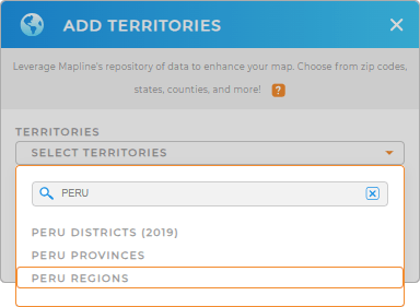
Quickly add a new territory from Mapline’s repository for smarter analysis and streamlined data management. Just type PERU in the search bar and select PERU REGIONS.
It couldn’t be any easier than that!


Pro Tip: Mapline’s global territory repository is a powerful asset for territory analysis. By adding boundaries of Peru including Peru districts, Peru provinces, and Peru regions to your map, you can improve your decision-making for enhanced business efficiency.
CHOOSE REGION COLORS
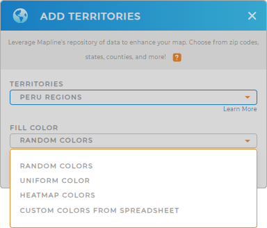
Elevate your mapping game with the perfect custom territory color styling! Thoughtfully selected colors turn your map into a visually striking, data-rich story that captivates and informs your audience.
With the right color styles, you can transform complex data into an engaging visual narrative that’s not only easy to understand but also actionable. After configuring your settings, click OK to start digging in to your map of Peru regions.

GET NEW TERRITORY INSIGHTS
Level up your data analytics when you add these powerful capabilities:
- Instantly merge territories to compare and contrast insights
- Get key customer insights when you add demographic data
- Unlock a powerful new lens to reveal hidden insights and seize untapped potential


