JORDAN GOVERNORATES
- Territory Guide
- JORDAN GOVERNORATES
A map of Jordan governorates is a gateway to enhance your data analytics and get location insights to craft a successful sales territory plan. By visualizing your market alongside the governorate boundaries, you can gain location-based insights that help pivot your sales territory planning and optimize marketing strategies. This approach allows you to analyze region-specific trends, enabling the creation of more informed, location-intelligent business plans. Explore key factors to understand your market, analyze the competition, and optimize your business operations.
Boost your data analytics as you dive deeper into the detailed governorate-level analysis. Here’s how.
WHAT ARE JORDAN GOVERNORATES?
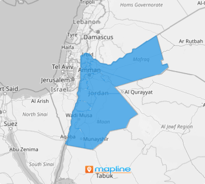
Jordan is a country located in Western Asia. It is divided into 12 governorates. Leveraging a governorate territory map can speed up your data analysis and increase your understanding of locations, sales, marketing, logistics, and operations. Add this territory to your map to plan strategically and execute timely initiatives.
Let’s take a minute (or less!) to start creating your map of Jordan governorates.
ADD JORDAN GOVERNORATES
Integrate Jordan governorates into your data map now and watch endless insights pouring in during your analysis! For businesses operating across the country, this approach is essential for effectively monitoring sales performance and optimizing strategies in each governorate.
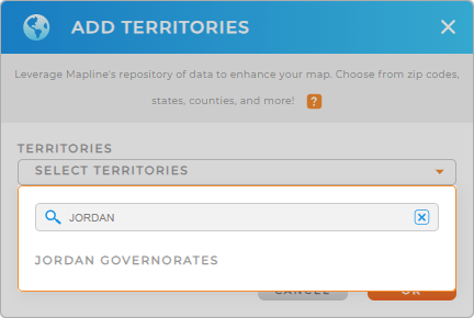
Start by adding a new territory from Mapline’s Repository. Then type JORDAN into the search bar and click JORDAN GOVERNORATES.
Now quickly turn your attention to Step 2.


Pro Tip: Use Mapline’s extensive repository of territory boundaries including Jordan governorates to enhance your ability to manage and analyze sales territories, especially if your business operates in multiple countries.
CHOOSE GOVERNORATE COLORS
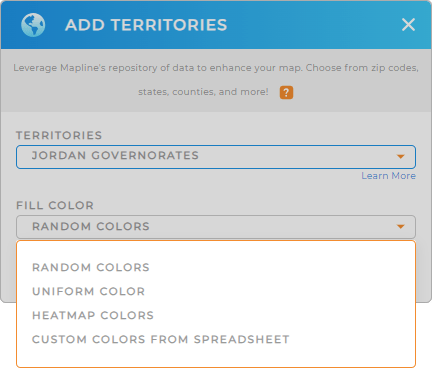
There’s no better way to visualize KPIs at a glance than through color-coded territories! For instance, when you apply static colors, you can differentiate sales territories managed by various sales reps. On the other hand, when you apply dynamic colors, you get to distinguish colored areas represented by different performance levels.
So Step 2 is about choosing the most appropriate color styles for your territories.
Follow these two simple steps and start utilizing your color-coded territory map!

GET NEW TERRITORY INSIGHTS
Now, add these advanced capabilities to your map of Jordan governorates and achieve profound results in your analytics:
- Analyze driver and route statistics with advanced routing
- Identify logistical challenges instantly when you apply coverage areas
- Add additional data to expand your data analysis


