ISLE OF MAN SHEADINGS
- Territory Guide
- ISLE OF MAN SHEADINGS
Harness the power of a map of Isle of Man Sheadings to supercharge your analytics. By making it an important part of your analytic toolkit, you can uncover hidden connections within sheading boundaries that ignite game-changing ideas to elevate your business. Visualize insights across each sheading to unlock actionable intelligence needed to make data-driven decisions.
And here’s the kicker: you can add these boundaries to your map in just a few seconds. The result? A dynamic, visualized landscape that empowers you to stay ahead of the curve. Ready to be amazed? Let’s revolutionize the way you work!
WHAT ARE ISLE OF MAN SHEADINGS?
The Isle of Man, a fascinating self-governing British Crown Dependency nestled in the Irish Sea, lies between Great Britain and Ireland. Steeped in history and tradition, this picturesque island was once organized into six ancient divisions known as sheadings: Glenfaba, Michael, Ayre, Garff, Middle, and Rushen. These sheadings, listed in a traditional clockwise order, were further divided into 17 parishes, forming the backbone of local governance.
Though their administrative role has faded over time, brands that leverage this type of sheading-level analysis find themselves gaining a deeper understanding of regional nuances, allowing them to tailor their strategies with precision. Acquire both detailed and broad insights as you navigate your analysis in this type of territory map to streamline your planning, sharpen your strategy, and watch your operations transform.
ADD ISLE OF MAN SHEADINGS
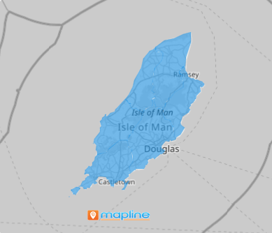
A detailed map of Isle of Sheadings is your secret weapon for uncovering powerful insights. Transform the way you work by crafting strategies to tap new markets, exceed customer expectations, and outpace the competition. With clear, actionable visuals, you’ll not only meet your goals—you’ll crush them!
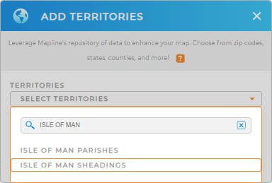
Get ready to redefine success in your business. Let’s start by adding a new territory from Mapline’s repository. In the search bar, type ISLE OF MAN and select ISLE OF MAN SHEADINGS.


Pro Tip: Looking to explore other areas of Isle of Man? Mapline’s global territory repository have both the Isle of Man parishes and sheadings. Add both territories to your map today to help you gain different insights from both perspectives.
CHOOSE SHEADING COLORS
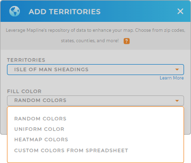
Now, bring your territory map to life with impactful color styling! Assign static colors to highlight key areas, such as tourist attractions or business districts, ensuring clarity and focus in your analysis. Take it a step further with dynamic colors that shift and adapt, creating an engaging visual narrative that captivates your audience.
Tailor your color styles to align perfectly with your analysis level.
Lastly, hit OK and dive into a whole new world of data exploration on your division map.

GET NEW TERRITORY INSIGHTS
Leverage these powerful capabilities to maximize the use of your map of Isle of Man Sheadings and tap into new data-driven insights:
- Visualize data density around your pins
- Incorporate new locations to your existing dataset in a snap
- Segment your customers by active or inactive in just a few clicks


