Guinea-Bissau Regions
- Territory Guide
- Guinea-Bissau Regions
A map of Guinea-Bissau regions is a great strategic move if you want to understand the geographic landscape at a regional level. This type of map empowers brands to pinpoint emerging opportunities, optimize resource allocation, and tailor their strategies to local nuances.
Make this map a must-have in your analytical toolkit. With it, you’ll make sharper decisions, discover untapped markets, and fine-tune routes and operations with pinpoint accuracy. Now, imagine leveraging a Guinea-Bissau region map as your secret weapon—not just for visualizing boundaries, but for unlocking new opportunities and propelling your success forward! Let’s check out how to tap into actionable insights that help you navigate and thrive in this dynamic market!
WHAT ARE GUINEA-BISSAU REGIONS?
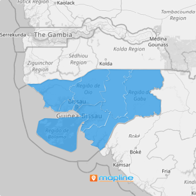
Guinea-Bissau is divided into eight regions, each with its own unique administrative and socio-economic characteristics. Adding Guinea-Bissau’s regional boundaries to a map can facilitate logistics planning, allowing for efficient routing and distribution of goods and services across different parts of the country.
Furthermore, understanding regional demographics and market trends aids in targeted marketing efforts, enabling brands to tailor campaigns to specific regions and customer segments. Visualizing Guinea-Bissau’s regional divisions empowers data-driven decision-making, optimized operations, streamlined processes, and enhanced market performance. Here’s how to get started.
ADD GUINEA-BISSAU REGIONS
When you map out key insights across Guinea-Bissau regions, you gain a strategic edge—refining your decisions and customizing growth strategies to align with local customer needs. Explore regional trends, uncover hidden opportunities, and build smarter business plans that drive real impact. With a clear, region-focused approach, every move becomes a step toward success!
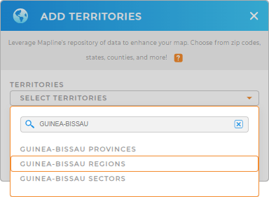
Quickly add Guinea-Bissau regions to your Mapline maps! First, add a new territory from Mapline’s repository. Next, type GUINEA-BISSAU into the searchbar and select GUINEA-BISSAU REGIONS.
And that’s it! Now you’re ready for Step 2.


Pro Tip: With Mapline’s worldwide territory repository, you can go beyond surface-level analysis and develop strategies that are both sharp and impactful. Dive into different territory analysis in Guinea-Bissau. Explore Guinea-Bissau provinces, regions, or Guinea-Bissau sectors to tap into different types of insights.
CHOOSE REGION COLORS
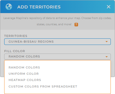
Accelerate your analysis by adding custom territory colors to your map!
This is a fantastic way to quickly identify high-performing areas, missed opportunities, and more!
Just select the type of color styling you need, click OK, then sit back and watch your map transform!

GET NEW TERRITORY INSIGHTS
That’s just the tip of the iceberg. Now that you’ve set the stage for territory analysis, let’s dive into some of the following capabilities:
- Use segments to hone in on different categories of your data
- Filter your data to see the precise statistics you need on your map
- See the data contained within each municipality with folder reports


