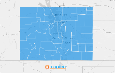
Close
WE'RE ALL ABOUT
YOUR
SUCCESS
HOW WOULD YOU LIKE TO GET IN TOUCH:
Email
Email
Calendar
Cal
Close
WE'RE ALL ABOUT
YOUR
SUCCESS
HOW WOULD YOU LIKE TO GET IN TOUCH TO SCHEDULE YOUR DEMO:
Email
Email
Calendar
Cal
Mapline - mapping made powerful Close
Give us a call. We'd love to talk!

+1 800.969.1454

Close
Close
Geo Mapping Starter Close

Experience the power

Get ready to see your data in a whole new way!
Territory Guide Icon
TERRITORY GUIDE

U.S. COUNTIES

U.S. county map is indispensable for various professionals across different industries, including election managers, educators, and sales and marketing professionals. Whether it’s analyzing consumer behavior, planning sales initiatives, or targeting specific markets, the U.S. county map serves as a crucial tool.

With Mapline, creating customized county maps is quick and easy, empowering users to access valuable geographical insights tailored to their specific needs. So why wait? Let’s dive in and create your personalized map now!

WHAT ARE U.S. COUNTIES?

U.S. counties are administrative divisions within states, each with its own government responsible for local governance and services.

Adding U.S. county boundaries to a map can offer valuable insights for logistics and sales operations. For instance, sales teams can use county boundaries to segment their target market, enabling them to tailor their marketing strategies and allocate sales resources effectively based on geographic proximity and demographic data.

This type of boundary provides a clear delineation of areas, aiding businesses in decision-making processes related to resource allocation, market segmentation, and operational planning.

ADD U.S. COUNTIES

Add U.S. counties to your map in a flash!

First, add a new territory from Mapline’s repository. Type US COUNTIES into the searchbar and select your desired county.

If you would like to add all U.S. counties to your map at once, select U.S. COUNTIES – ALL STATES.

Now, let’s check out how to style your territories to get the most out of your data!

Choose to add U.S. Counties
magnifying glass with a checkmark inside

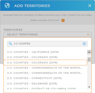
Pro Tip: Mapline provides the latest County boundaries available from the U.S. Census Bureau. Select the most recent year to get the most up-to-date boundaries.

CHOOSE COUNTY COLORS

Elevate your data presentation with customized fill colors! This is your map’s hidden gem, enhancing both functionality and aesthetics, and empowering you to quickly identify key insights.

Simply choose the type of color you need, then click OK.

It’s as easy as that. Now you’re ready to use your map of U.S. counties to reveal new insights about your brand!

Color styles for U.S. Counties

GET NEW TERRITORY INSIGHTS

Now that you have your map of US counties, what’s next? Well, you just opened the gate to so many possibilities! For example, you can:

Map of U.S. Counties
Have questions? Want to see this in action?