CAPE VERDE MUNICIPALITIES
- Territory Guide
- CAPE VERDE MUNICIPALITIES
Harness the power of Cape Verde municipalities and transform your brand’s analytics and operational efficiency. This map is your toolkit for getting the most out of your visualizations. Why? Because you can see through smaller administrative units that provide a granular view of local dynamics, allowing for more precise marketing, streamlined logistics, and improved customer engagement strategies. By leveraging this detailed mapping, you can identify high-potential target markets and optimize your sales routes.
Embrace the potential of mapping Cape Verde municipalities today and unlock new business growth opportunities!
WHAT ARE CAPE VERDE MUNICIPALITIES?
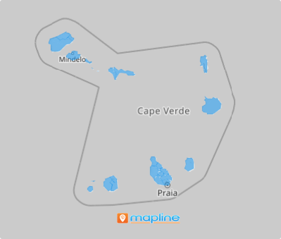
Located in the central Atlantic Ocean, Cape Verde is divided into 22 municipalities or concelhos. Each municipality operates with two governing bodies: the Municipal Assembly, which serves as the legislative body, and the Municipal Chamber, responsible for executive functions. This structure provides a localized approach to governance, allowing each municipality to address the specific needs of its communities while fostering efficient regional administration.
Tap into business growth with the power of a municipality map of Cape Verde. Leverage analyzing at this level of granularity to unlock new opportunities at a hyper-local level and build innovative approaches to boost your business. Analyzing at a municipality-level leads to enhancing your customer-centric approach, identifying key location hotspots, optimizing services, and driving growth in this thriving market. Start mapping at the municipality level to fuel your business success!
ADD CAPE VERDE MUNICIPALITIES
Creating a map of Cape Verde’s municipalities is a straightforward process that will lead you on an insightful journey of geospatial analysis for your business growth. By integrating these municipalities into your mapping strategy, you take a crucial step toward achieving a comprehensive understanding of the market and optimizing your operations.
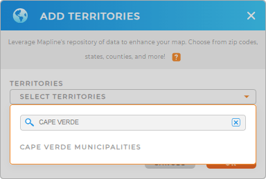
Add a new territory from Mapline’s repository by clicking on the ADD button on the left side of your map. Then type CAPE VERDE into the search bar to quickly add CAPE VERDE MUNICIPALITIES to your map in no time!
This approach not only enhances your strategic planning but also empowers you to make informed decisions that can elevate your tourism offerings and drive sustainable growth.


Pro Tip: Get access to Mapline’s extensive worldwide territory repository to add different territory boundaries including Cape Verde municipalities to your map and enhance your strategic analysis capabilities.
CHOOSE MUNICIPALITY COLORS
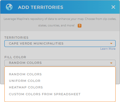
Applying color styles to municipality boundaries on your map is an excellent way to elevate your analytics. This visual enhancement allows you to gain regional insights at a glance, making it easy to differentiate between key data points, such as high-potential target markets and regional demographics. With this colorful representation, you can quickly identify trends, assess opportunities, and make data-driven decisions that drive your business forward.
Customize your map by selecting the best territory color styles that best suit your analytical needs. Once you’ve configured your settings, click OK.
Now your map is ready to analyze! How amazing is that?

GET NEW TERRITORY INSIGHTS
Elevate your analytics and drive growth when you leverage powerful capabilities that allow you to dive deeper into your data, revealing trends and opportunities in your map of Cape Verde municipalities.
- Visualize data density and easily identify trends within municipalities
- Segment your data to tailor marketing campaigns and improve engagement strategies
- Manage distance calculations between municipalities to optimize logistical operations


