MALI CERCLES
- Territory Guide
- MALI CERCLES
Unlock powerful insights and elevate your territory analysis by mapping your information across Mali’s cercles. Visualizing connections within each cercle reveals hidden patterns and critical factors that can drive your business forward. A detailed cercle-level analysis doesn’t just give you a bird’s-eye view; it equips you with the precise insights you need. You’ll be able to tailor territory assignments with pinpoint accuracy, zero in on your target markets, and streamline your operations to make them as efficient as a well-oiled superhero machine!
Dive into this analysis, and you’ll see how it supercharges your strategy, turning complex information into actionable intelligence.
WHAT ARE MALI CERCLES?
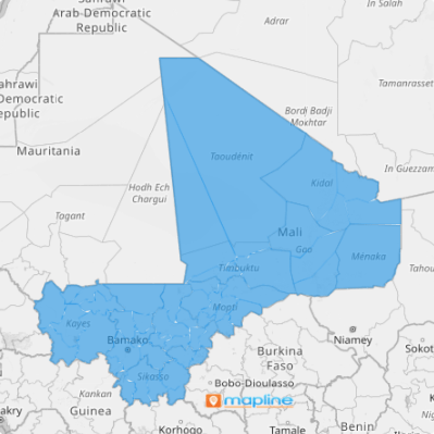
Mali, nestled in West Africa, has been meticulously divided into 56 cercles since 2016—these are the crucial second-level administrative divisions that form the backbone of the country’s structure. Now, imagine supercharging your insights by layering it onto a cercle territory map. This powerful visualization isn’t just a cool trick; it’s your gateway to uncovering groundbreaking insights from the intricate dance between data layers and cercle boundaries.
No matter what industry you’re in, this approach transforms insights into actionable intelligence. You’ll see how understanding these connections can propel your business forward, sparking growth and driving success. Dive into this method, and watch as your business transforms into a powerhouse of strategic insight and operational excellence. The road to success is paved with the right territory analysis—let’s chart that course together!
ADD MALI CERCLES
You can add Mali cercles to your map in a few seconds you won’t even recognize you’re done. This step is crucial to unlocking new opportunities, enhancing operational efficiency, and making more informed strategic decisions.
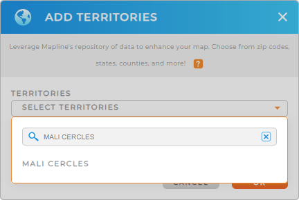
To make the process smoother for you, first, add a new territory from Mapline’s repository. Type MALI into the search bar and click to add MALI CERCLES.
You’re almost done. Now, let’s check out the next step.


Pro Tip: Mapline’s territory repository has a comprehensive list of boundaries including Mali regions and cercles. Elevate your analysis as you add these territories to explore more geographic insights that have a great impact on your business.
CHOOSE CERCLE COLORS
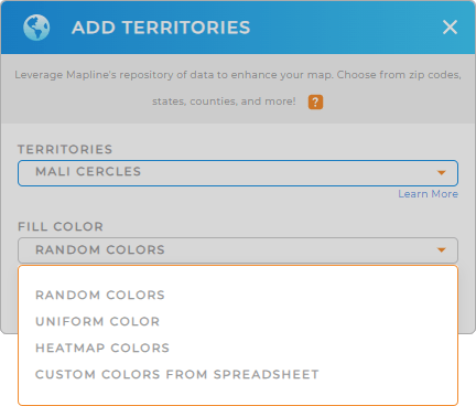
Next, maximize the use of your map of Mali cercles as you add territory colors. Colors quicken how you interpret your data. Incorporating colors into your territory map ignites more insights for strategic planning and decision-making.
It’s so easy to add the perfect color styles for you. Simply choose one from the drop-down menu – random, uniform, heat map, and custom color. Once you have configured your territory color, click OK to wrap up the process.
And that’s it! Now let’s dive into analyzing your data on a map of Mali cercles.

GET NEW TERRITORY INSIGHTS
Streamline your analytics as you apply these powerful capabilities to your map of Cercles:
- Apply market segments to reveal deeper insights into your team’s performance and operational efficiency.
- Calculate driving distance to estimate travel times and fuel costs
- Visualize the factors affecting your sales territories with coverage circles


