
Extract Insights From Mapping Prefectures of CAR
Make Mapline Your Partner in Prefecture-Level Analysis
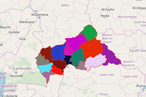
Mapping Prefectures of CAR may take you to untapped potentials of the country. The Central African Republic (more popularly known by its abbreviation “CAR”) is divided into 16 prefectures: 2 economic prefectures and 1 autonomous commune. These prefectures are further divided into 71 sub-prefectures. The country is known for its mineral deposits such as diamonds, gold, cobalt, and uranium. With better understanding and management, potential areas can be developed and enriched for a sustainable economy.
When analyzing a prefecture map of CAR, mapping tools such as dot density, geographic heat maps, and radial heat maps are proven to be very significant. When applied, the map turns out to be visually appealing, making extraction of ideas easier. More than that, the map helps you streamline analyses and bring sharp insights to the table.
Steps to Create a CAR Prefecture Map
A few seconds more and your map is ready to be used! Start extracting insights from data and boundaries using different powerful mapping tools!
- Create a Mapline account and login.
- Click the orange “Add New Items” button.
- Select “New Map” on the drop down arrow.
- Give your map a name and click “OK.”
- Click the “Add” button from the left sidebar.
- Select the “Territories” option.
- Click “From Mapline’s Repository.”
- From the “Territories” select “Central African Republic Prefectures.” Use the search bar for quicker results.
- Select how you want your boundaries to be colored in “Fill Color” (Random Colors, Uniform Color, Dynamic heat map colors, or Custom colors from spreadsheet).
- Click “OK.”
Mapping Prefectures of CAR is that easy! Once you have your map, you can create a map of Excel spreadsheet locations to overlay on top. Mapline also makes it simple to see summary information about the locations inside each prefecture just by clicking on them. Sign up now and start extracting insights from your data and territory map!