
Lesotho District Map in Business and Market Analysis
Analyze Population Data on a District-Level Map
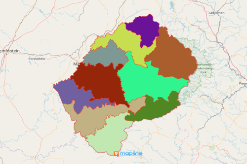
A Lesotho district map is used as a business data map to show sales and profits. Lesotho is a landlocked country located in South Africa. It is divided into 10 districts which are further divided into 80 constituencies. Constituencies consist of 129 local community councils. Lesotho’s economy is predominantly based on manufacturing goods and exporting natural resources. The country’s most significant natural resources are diamonds and water. Used as a data map, your district map of Lesotho displays impactful visualization that shows your sales and profits on each district area. A heat map is often used to achieve targeted advertising. For an optimized transportation network, use Mapline’s route software to understand the distribution of manufactured goods all over the country.
Use Mapline’s population data mapping to analyze and classify customers in different districts. The data helps to figure out their lifestyle, interests and shopping habits. If you want to focus your analysis on a particular group of people, segment your data. This tool helps to find your target market in a zip!
Add Population Data on a Map of Districts of Lesotho
Create a map with district boundaries following these steps. Then, add your Excel data of locations in seconds to start your analysis.
- Create a Mapline account and login.
- Click the orange “Add New Items” button.
- Select “New Map” on the drop down arrow.
- Give your map a name and click “OK.”
- Click the “Add” button from the left sidebar.
- Select the “Territories” option.
- Click “From Mapline’s Repository.”
- From the “Territories” select “Lesotho Districts.” Use the search bar for quicker results.
- Select how you want your boundaries to be colored in “Fill Color” (Random Colors, Uniform Color, Dynamic heat map colors, or Custom colors from spreadsheet).
- Click “OK.”
That’s how easy it is to create a Lesotho district map! Mapline also makes it simple to see summary information about the locations inside each district just by clicking on them! Sign up now to leverage population data for better business management.