
Insights From Plotting Data on a Liberia Map Showing Counties
Data and Boundaries Work Hand-in-Hand for Powerful Data Analysis
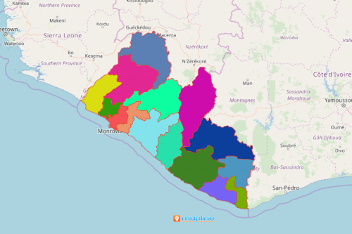
Do away with time-consuming data analysis when you overlay your Excel data on a Liberia map showing counties. Liberia, also known as “Land of the Free,” is a country on the West African coast. It is divided into 15 counties which are subdivided into 90 districts. The districts are further subdivided into clans. Most organizations map the county boundaries of Liberia to pinpoint areas that can further be developed in terms of exporting goods. The country is well-known for its export products, especially diamonds and gold. Recently, there is a significant upward trend on exporting palm oil and cocoa.
Use mapping tools for data analysis of a county map of Liberia. One highly recommended tool is the radial heat map. It helps monitor your export business activity. How? Because it organizes and color codes your data, a radial heat map helps to spot areas that are viable for new site locations or have market potentials. As a result, you can easily identify insights drawn from territory activity levels. You can focus on high-density areas. On the other hand, you can plan for the best actions to take on how to improve business activities in low-density areas.
Liberia County Map Reveals Opportunities and More!
Start mapping country boundaries as you follow these easy steps. Then, add Excel location data to spot opportunities, new market, patterns and trends.
- Create a Mapline account and login.
- Click the orange “Add New Items” button.
- Select “New Map” on the drop down arrow.
- Give your map a name and click “OK.”
- Click the “Add” button from the left sidebar.
- Select the “Territories” option.
- Click “From Mapline’s Repository.”
- From the “Territories” select “Liberia Counties.” Use the search bar for quicker results.
- Select how you want your boundaries to be colored in “Fill Color” (Random Colors, Uniform Color, Dynamic heat map colors, or Custom colors from spreadsheet).
- Click “OK.”
That’s how easy it is to create a Liberia map showing counties! Mapline also makes it simple to see summary information about the locations inside each county just by clicking on them! Sign up now and allow our powerful mapping tools to help you draw insights from your data analysis.