
How a Libya Map Showing Districts is Used by Oil Sector
District Map for Situational Awareness Analysis
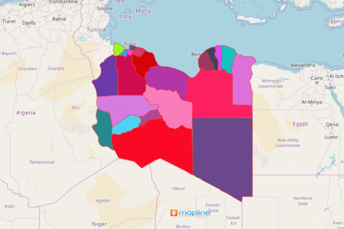
There is a lot of usage of a Libya map showing districts for organizations in the oil sector. Libya is the 4th largest country in Africa and considered to be the 16th largest country in the world. It is divided into 22 districts which are further subdivided into Basic People’s Congresses as townships or boroughs. Some uses of a Libya district map include site selection, risk management, identifying people and assets, routing deliveries, and more.
Organizations usually consult a map of Excel location data with an overlay of district boundaries for spatial analysis. When applying heat maps, the data visualization reveals vulnerabilities of areas thereby planning ahead to mitigate risks. The map can also be shared in just a few clicks. It helps share updated information real-time so that team members are aligned with one goal in mind.
District Map of Libya as Your Trail to Preparedness
Once done overlaying district boundaries, start plotting addresses to prepare plans for evacuation and mitigation. In this way, you can save lives and properties should there arise an emergency situation.
- Create a Mapline account and login.
- Click the orange “Add New Items” button.
- Select “New Map” on the drop down arrow.
- Give your map a name and click “OK.”
- Click the “Add” button from the left sidebar.
- Select the “Territories” option.
- Click “From Mapline’s Repository.”
- From the “Territories” select “Libya Districts.” Use the search bar for quicker results.
- Select how you want your boundaries to be colored in “Fill Color” (Random Colors, Uniform Color, Dynamic heat map colors, or Custom colors from spreadsheet).
- Click “OK.”
That’s how easy it is to create a Libya map showing districts! Mapline also makes it simple to see summary information about the locations inside each district just by clicking on them! Sign up now to start planning and analyzing for situational awareness.