
Improve Farm Management Using Mali Region Map
Mapline Solution Suite – Creating Solutions for Your Farm Management
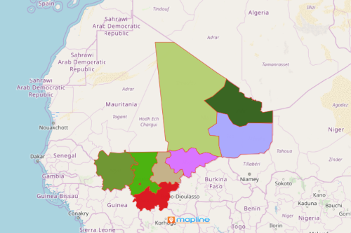
Maximize your data and territory analysis on a Mali region map with Mapline’s Solution Suite. Mali is the 8th largest country in the African continent. Mali has 8 regions and 1 capital district. The regions are further divided into 49 cercles. These are also divided into 703 communes. Agriculture is the country’s major industry. It produces corn, millet, rice, tobacco, tree crops, and vegetables and exports them to neighboring countries.
Try the Mapline Solution Suite as your go-to mapping platform! Your region map of Mali will not only guide you to the territory boundary analysis. More than that, it will allow you to maximize your mapping experience using powerful mapping tools so you can better manage your business. Using tools for mapping, routing, business intelligence, and automation significantly helps in agricultural management. They let you see the value of agricultural products and reduce costs significantly.
Steps to Create a Mali Regions Map
In less than a minute, your map of region boundaries can be generated.
- Create a Mapline account and login.
- Click the orange “Add New Items” button.
- Select “New Map” on the drop down arrow.
- Give your map a name and click “OK.”
- Click the “Add” button from the left sidebar.
- Select the “Territories” option.
- Click “From Mapline’s Repository.”
- From the “Territories” select “Mali Regions.” You can use the search bar to enter the name of the territory.
- Select how you want your boundaries to be colored in “Fill Color” (Random Colors, Uniform Color, Dynamic heat map colors, or Custom colors from spreadsheet).
- Click “OK.”
That’s how easy it is to create a Mali Region map! Once you have your map, you can create a map of Excel spreadsheet locations to overlay on top. Mapline also makes it simple to see summary information about the locations inside each region just by clicking on them! Sign up now and make Mapline Solution Suite be the solution for all your analytical needs.