
Drought Risk Assessment Using Niger Region Map
Region-Level Map Used to Create Workable Solutions
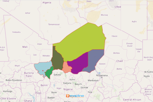
Government agencies depend on a Niger region map to help them manage risks such as drought in the country. Niger is the largest country located in Western Africa. It is divided into 7 regions and 1 capital district. Regions are further divided into 36 departments which are further divided into communes. To avoid experiencing a trail of disasters brought by droughts, government department heads and community leaders create drought risk assessments.
Applying mapping tools on a region map of Niger ignites ideas for workable solutions to reduce drought impacts. Heat maps provide instant visibility to “high activity” regions. On the other hand, a coverage tool lets you create a back-up plan. Respond quickly even before something happens.
Create and Share Niger Map Showing Regions
A few seconds of creating a region-level map, start sharing the map to community leaders, volunteers, and other response agencies.
- Create a Mapline account and login.
- Click the orange “Add New Items” button.
- Select “New Map” on the drop down arrow.
- Give your map a name and click “OK.”
- Click the “Add” button from the left sidebar.
- Select the “Territories” option.
- Click “From Mapline’s Repository.”
- From the “Territories” select “Niger Regions.” Use the search bar for quicker results.
- Select how you want your boundaries to be colored in “Fill Color” (Random Colors, Uniform Color, Dynamic heat map colors, or Custom colors from spreadsheet).
- Click “OK.”
That’s how easy it is to create a Niger region map! Once you have your map, you can create a map of Excel spreadsheet locations to overlay on top. Mapline also makes it simple to see summary information about the locations inside each region just by clicking on them! Sign up now to start creating drought risk assessments that tailor-fits to specific sectors and affected communities.