
Mapping City Districts of Somalia for Mental Health Studies
Map Mogadishu Districts for Focused Data Analysis
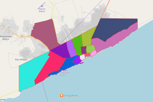
One of the reasons why mapping city districts of Somalia is very important to the health sector is that they want to intensify the mental health services in the country. Somalia is a country nestled in East Africa. Its capital and most populous city is Mogadishu. The World Health Organization (WHO) reported that 1 in 3 persons have been affected by some form of mental illness. In spite of that, there are only a few mental health services located in Mogadishu. Since the outbreak of civil war in 1991, there has been an increase in mental health studies. The goal is to improve the mental health system. Such studies use territory maps such as city districts of Mogadishu to collect information and drive information-based mental health plans.
Some of the mapping tools that are very helpful and practical in these studies are demographic analysis map and heat mapping. These tools help turn simple data analysis to awesome data visualization that ignites insights. Actionable insights are thus used to monitor progress, provide community services, and active distribution of information about care and rehabilitation, mental health promotion, and prevention.
Create a Map of Mogadishu Districts
Creating a map with all the districts of Mogadishu can be done under a minute:
- Create a Mapline account and login.
- Click the orange “Add New Items” button.
- Select “New Map” on the drop down arrow.
- Give your map a name and click “OK.”
- Click the “Add” button from the left sidebar.
- Select the “Territories” option.
- Click “From Mapline’s Repository.”
- From the “Territories” select “Somalia City Districts.” Use the search bar for quicker results.
- Select how you want your boundaries to be colored in “Fill Color” (Random Colors, Uniform Color, Dynamic heat map colors, or Custom colors from spreadsheet).
- Click “OK.”
Sign up now and learn how Mapline provides more mapping tools for mental health research and studies to strengthen strategic plans.