
Use The States Map of South Sudan as a Locations Intelligence Tool
State-Level Mapping to Enhance Geospatial Thinking
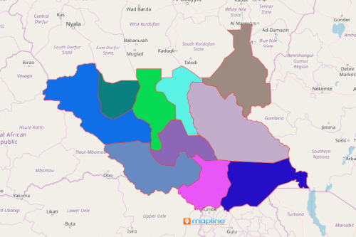
A states map of South Sudan is used by an increasing number of organizations to solve impending issues and concerns, especially in protecting natural resources. South Sudan is a country located in Northeastern Africa. Its land area is around 4 times larger than the state of Georgia in the US. The country is divided into 10 states which are further divided into 86 counties. Agriculture is the number one factor in its economic growth. The country prides in its natural resources such as oil, diamonds, gold, silver and other minerals.
A map of States of South Sudan used as a location intelligence tool can help you gain competitive advantage. The Mapline Solution Suite is a complete package to make mapping more powerful! It is a comprehensive platform that provides tools to use in mapping, routing, business intelligence, and data automation.
Data and Mapping States Lead to Business Strategic Growth
Start by mapping the locations of the resources and the customers and get ready to be blown away by a lot of patterns and trends that help you analyze where the market is leading you. Begin by creating a South Sudan map showing states now:
- Create a Mapline account and login.
- Click the orange “Add New Items” button.
- Select “New Map” on the drop down arrow.
- Give your map a name and click “OK.”
- Click the “Add” button from the left sidebar.
- Select the “Territories” option.
- Click “From Mapline’s Repository.”
- From the “Territories” select “South Sudan States.” Use the search bar for quicker results.
- Select how you want your boundaries to be colored in “Fill Color” (Random Colors, Uniform Color, Dynamic heat map colors, or Custom colors from spreadsheet).
- Click “OK.”
That’s how easy it is to create a states map of South Sudan! Once you have your map, you can create a map of Excel spreadsheet locations to overlay on top. Mapline also makes it simple to see summary information about the locations inside each state just by clicking on them! Sign up now and take advantage of using more locations analytical tools.