
Trim Down Time Spent in Territory Analysis by Mapping Prefectures of Togo
Prefecture-Level Mapping for Enhanced Territory Analysis
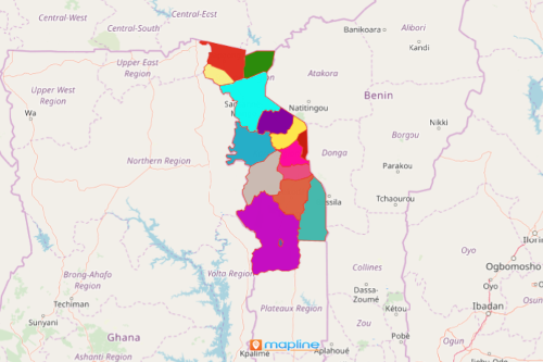
Mapping prefectures of Togo is one of the best ways to significantly cut the amount of time used in data analysis. If you have Excel data of locations, simply add it to a map of Togo prefectures. In minutes, you can clearly visualize the connection between the locations and their boundaries.
The data interaction is made more powerful when other mapping options are used like distance analysis and heat maps. When these powerful mapping tools are used, you can easily understand how your Excel data interrelates. Indeed, the tools work together to build a powerful data visualization!
Easy Steps to Create a Prefecture-Level Map
Got a minute? Just follow these 10 easy steps and your map of Togo prefectures is already built right before your eyes. Oh, did I say a minute? Try it in just a few seconds! Within a few seconds you will have a powerful visual that lets you identify trends and patterns from data correlations.
- Create a Mapline account and login.
- Click the orange “Add New Items” button.
- Select “New Map” on the drop down arrow.
- Give your map a name and click “OK.”
- Click the “Add” button from the left sidebar.
- Select the “Territories” option.
- Click “From Mapline’s Repository.”
- From the “Territories” select “Togo Prefectures.” Use the search bar for quicker results.
- Select how you want your boundaries to be colored in “Fill Color” (Random Colors, Uniform Color, Dynamic heat map colors, or Custom colors from spreadsheet).
- Click “OK.”
In Mapline, we design and innovate mapping solutions that work for your needs. Sign up now to start discovering all our mapping tools for your data analysis and business decision-making.