
Unfold Location Analysis Stories by Using Uganda Region Map
Find New Patterns in Region-Level Mapping
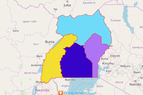
Think of how a Uganda region map can help you with your location analysis. Uganda is a country in Africa which is divided into 4 regions: Central, Eastern, Northern, and Western. The Central Region, while having the least number of district boundaries, is the country’s most populated region. On the other hand, the Northern region with 30 districts has the least populous region. A region map of Uganda is often considered as a location analysis tool. When a region map is overlaid with Excel data, new patterns emerge. Location insights are captured due to data-driven visualization.
How to Create a Map of Regions of Uganda
Easy! Just follow these steps:
- Create a Mapline account and login.
- Click the orange “Add New Items” button.
- Select “New Map” on the drop down arrow.
- Give your map a name and click “OK.”
- Click the “Add” button from the left sidebar.
- Select the “Territories” option.
- Click “From Mapline’s Repository.”
- From the “Territories” select “Uganda Regions.” Use the search bar for quicker results.
- Select how you want your boundaries to be colored in “Fill Color” (Random Colors, Uniform Color, Dynamic heat map colors, or Custom colors from spreadsheet).
- Click “OK.”
Once your map is generated, try adding labels on each region boundary. You may want to add coverage overlay or measure distances between locations. That’s how easy it is to create a Uganda region map! Mapline also makes it simple to see summary information about the locations inside each region just by clicking on them. Sign up now!