AMERICAN INDIAN TRIBAL SUBDIVISIONS
- Territory Guide
- AMERICAN INDIAN TRIBAL SUBDIVISIONS
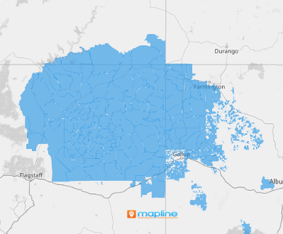
A map of American Indian Tribal subdivisions isn’t just about seeing lines on a map—it’s about discovering the pulse of vibrant communities! By integrating your data with these specific administrative boundaries, you gain a laser-focused view that reveals underlying trends and patterns. Think of it as your super tool for zooming into areas where you can make the biggest impact, enhancing both your strategic decisions and operational agility.
Ready to unleash the full potential of your data? Let’s get these tribal subdivisions onto your map and start turning that data into decisions!
WHAT ARE AMERICAN INDIAN TRIBAL SUBDIVISIONS?
American Indian tribal subdivisions are federally recognized areas within American Indian reservations or as part of Oklahoma Tribal Statistical Areas (OTSAs). These subdivisions represent distinct units of governance, playing a crucial role in preserving cultural heritage and administering local affairs.
Looking to deepen your market presence or boost engagement within these unique communities? Start by mapping American Indian tribal subdivisions. For example, perhaps you recognized that the Tohono O’odham Nation is home to many small businesses and large operations. As you identify customer behavior and buying patterns, you can tailor your strategies to local preferences and uncover new opportunities. Visualizing your data in context can open a treasure trove of opportunities, helping you to tailor your approaches and connect more meaningfully. Let’s dive in and see the transformative power of this detailed mapping!
ADD SUBDIVISIONS
Enhance your analytic capabilities to identify regional trends that help you craft hyper-local marketing strategies or streamline your logistics.
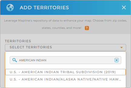
Simply add a new territory from Mapline’s repository by typing AMERICAN in the search bar and select AMERICAN INDIAN TRIBAL SUBDIVISIONS from the drop-down selection.
With the right territory in place, let’s go on to the last step.


Pro Tip: Leverage Mapline’s comprehensive repository of territories to access more administrative boundaries for the United States!
For data accuracy, Mapline uses terms like ‘American Indian’ in line with the U.S. Census Bureau’s terminology. However, in our communications, we prioritize the preferred nomenclatures of Indigenous peoples to respect their identities. We are committed to honoring the preferences of these communities.
STYLE SUBDIVISIONS
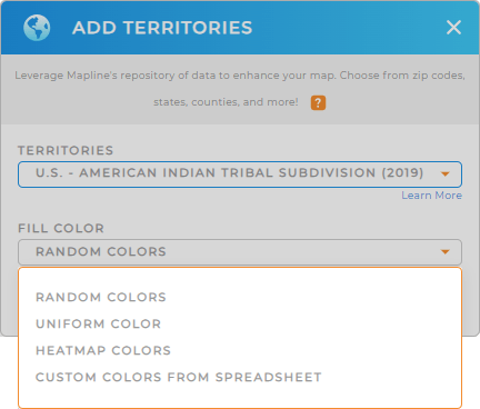
The last step is to apply custom colors to your territory. Custom territory styling plays a crucial role in enhancing the visual appeal of your map and making complex data more understandable. By applying color styles whether it’s random colors, uniform, heat map, or custom colors, you can effectively highlight key information, making it easier to draw insights for better decision-making.
Select the color styling that best suits your type of analysis. Once you have configured your settings, click OK.

GET NEW TERRITORY INSIGHTS
Capture more possibilities to reveal clear-cut insights hidden in your data by leveraging these powerful capabilities to intensify your map of American Indian tribal subdivisions:
- Visualize service coverage with coverage areas
- Calculate U.S. demographic data within each tribal subdivision to uncover exactly where your ideal customers are
- Create a new dashboard where you can keep all of your visualizations and metrics in one place


