
Bangladesh District Map – A Clear Territory Guide for Oil and Gas Companies
How a District Map of Bangladesh is Used to Reveal Opportunities
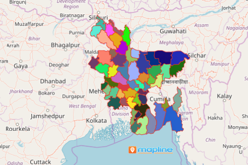
A Bangladesh district map is a helpful tool for the oil and gas industry. To thrive even better and remain relevant in a fast-paced industry setting, many companies rely on a district map of Bangladesh. The country is divided into 64 districts which are further divided into 495 sub districts as of July 26,2021.
As one of the top producers of natural gas in Asia, oil and gas companies rely on a map of Bangladesh showing all 64 districts. Then, they add Excel spreadsheet locations of untapped gas reserves, oil companies, distributors, and population by district. This map plotting strategy is a more organized way to reveal new business opportunities.
Easy Steps to Create a Bangladesh District Map
A few seconds is all it takes for a district-level mapping. Then, you can start your data and territory analyses by district to find new opportunities!
- Create a Mapline account and login.
- Click the orange “Add New Items” button.
- Select “New Map” on the drop down arrow.
- Give your map a name and click “OK.”
- Click the “Add” button from the left sidebar.
- Select the “Territories” option.
- Click “From Mapline’s Repository.”
- From the “Territories” select “Bangladesh Districts.” Use the search bar for quicker results.
- Select how you want your boundaries to be colored in “Fill Color” (Random Colors, Uniform Color, or Custom colors from spreadsheet).
- Click “OK.”
Once you have generated your map of Bangladesh showing districts, you can use other insightful mapping tools such as customizing data or segmenting your data to enhance your data analysis. Sign up now and experience a whole new level of data and territory analysis with Mapline!